Windsor NewsFor the people, For the city.

The Rose City rose. A nod to Windsor's City of Roses nickname. Original artwork by Windsor News.

Rose City Roots · Neighbourhoods

Neighbourhoods

The towns that became one city, and how each began. Windsor, Sandwich, Walkerville and East Windsor (Ford City) joined in 1935. Riverside and Ojibway followed in 1966. Historic photographs already on this page and on the chapter links stay in those places.

How each began

Windsor as it stands now was assembled from once-separate towns. The short accounts below are drawn from the City of Windsor's History of Windsor (text courtesy of Museum Windsor) and from chapters already on this exhibition. Historic street and neighbourhood photographs already published on those chapters stay there, so they are not repeated here. Follow the chapter links for the pictures and the longer record.

Sandwich

In 1797, after the purchase of the Huron Church Reserve, the town site of Sandwich was laid out as a British administrative headquarters. The City of Windsor calls this the first urban settlement in the area. Sandwich was incorporated as a town in 1858. It was one of the four municipalities joined to form the City of Windsor in 1935. The War of 1812, the French shore, and the Freedom Shore story all pass through this town. Sandwich and the New Border · Nations of the Strait · War on the River · Freedom Shore

Sources: City of Windsor, History of Windsor · City of Windsor, Former Municipal Boundaries poster

Windsor

The settlement around the ferry landing was known as the Ferry, Richmond or South Detroit before it agreed on the name Windsor in 1836. It became a village in 1854, a town in 1858, and a city on 14 April 1892. That Windsor of 1892 is the core that later absorbed its neighbours. Rails, Ferries and Crossings tells the ferry and railway side of that beginning.

Sources: The Canadian Encyclopedia, Windsor · City of Windsor, History of Windsor · City of Windsor, Former Municipal Boundaries poster

Walkerville

East of the village of Windsor, a community the City calls "Walker Town" grew around Hiram Walker's distillery and flour mill. The City's boundaries poster dates the distillery to 1858 and the Town of Walkerville to 1890-1935. The town later supported other industries, including auto manufacturing. Walkerville voters balloted heavily against amalgamation in December 1934; the provincial Act still proceeded. Border Cities · Works and Wages

Sources: City of Windsor, History of Windsor · City of Windsor, Former Municipal Boundaries poster · City of Windsor (Amalgamation) Act, 1935, as already cited on this page

Ford City, later East Windsor

Ford City grew with the Ford plant. Gordon McGregor founded the Ford Motor Company of Canada on 17 August 1904 in the former Walkerville Wagon Works, just east of Walkerville. The City of Windsor says Ford City became a village in 1913 and a town in 1915, and that by 1928 its population totalled 16,000. Soon after, it was renamed East Windsor and incorporated as a city. It was one of the four partners in the 1935 amalgamation. Drouillard Road, the old town's main street, takes its name from a French farm family; the City's Ford City Walking Tour notes that François Drouillard donated land in 1884 for the parish of Notre Dame du Lac, later Our Lady of the Rosary. Works and Wages

Sources: City of Windsor, History of Windsor · City of Windsor, Ford City Walking Tour · Works and Wages (Ford of Canada, 17 August 1904)

Riverside

Riverside was not part of the 1935 Act. The City of Windsor says it was once part of Sandwich East Township, a primarily residential area east of Windsor, separated from the township in 1913 and made a town in 1921. The Windsor Public Library describes that incorporation as taking place in May 1921. The City notes that street names such as Belleperche and Lauzon honour early French settlers. Riverside joined Windsor in 1966, with Ojibway and parts of the Sandwich townships. A roadhouse from this shore, the Edgewater Thomas Inn, is already pictured on Rum Row.

Sources: City of Windsor, History of Windsor · Windsor Public Library, Riverside Reaches 100 · City of Windsor, Former Municipal Boundaries poster

Ojibway

The Town of Ojibway was incorporated in 1913. The City of Windsor says it was intended to be a company town for the Canadian Steel Corporation, and that the project never fully developed, for financial reasons. It became part of Windsor effective 1 January 1966. Today the area includes Ojibway Park and the Ojibway Prairie Provincial Nature Reserve, which are treated on Natural Windsor. A longer account of the steel-town plan is on our desk story The steel town that never came.

Sources: City of Windsor, History of Windsor · Ontario Energy Board, Decision and Order EB-2007-0800 (former Town of Ojibway part of Windsor effective 1 January 1966)

A later annexation of land from the Town of Tecumseh, in 2003, created the city's present eastern edge. The 1935 and 1966 boundary changes, and the two Heritage Conservation Districts, remain documented in Names on the Map below.


Sandwich

Read the chapter.

Assorted buildings in Sandwich, 1913
Assorted buildings in Sandwich, 1913. Windsor, Ontario, Canada, 1913, compiled by Harry Wentworth Gardner (Windsor: Evening Record, 1913), p. 28. Photographer uncredited. Public domain. Via Canadiana.ca / Wikimedia Commons.
Assorted schools and churches in Sandwich
Assorted schools and churches in Sandwich. Assorted schools and churches in Sandwich, Windsor, 1913. From Windsor, Ontario, Canada, 1913, compiled by H. W. Gardner (Evening Record), p. 29. Public domain. Via Canadiana and Wikimedia Commons.
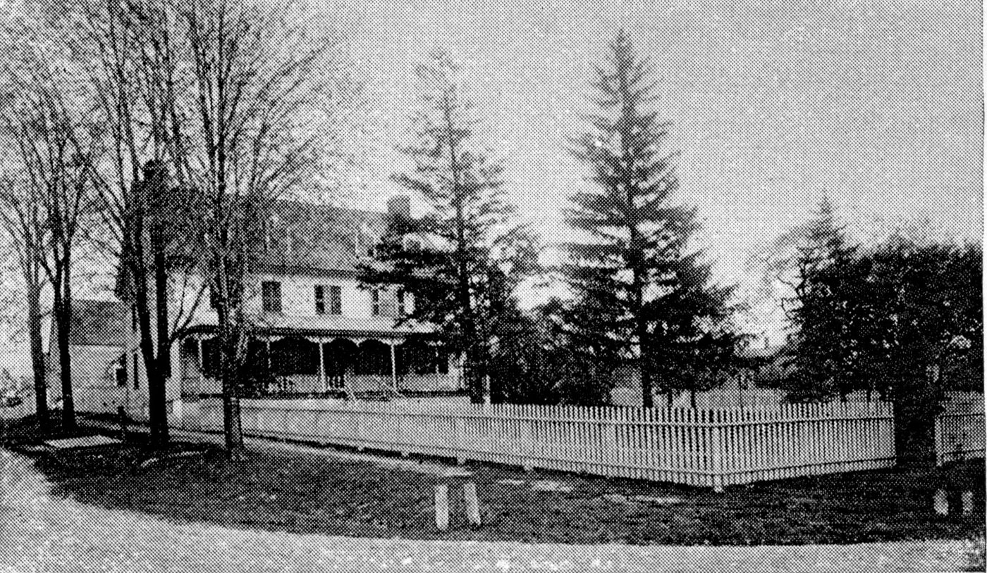
'Col. Baubie Mansion' (Duff-Baby House), Picturesque Detroit 1893
'Col. Baubie Mansion' (Duff-Baby House), Picturesque Detroit 1893. Duff-Baby House, in Picturesque Detroit and Environs (1893), p. 82. SWODA. Public domain.
François Baby House (2005)
François Baby House (2005). François Baby House, 2005. Madelyn De Valle, Windsor's Community Museum. Public domain, via Wikimedia Commons.

Walkerville

Read the chapter.

Devonshire Road looking north, Walkerville, 1913
Devonshire Road looking north, Walkerville, 1913. Windsor, Ontario, Canada, 1913, compiled by Harry Wentworth Gardner (Windsor: Evening Record, 1913), p. 72. Photographer uncredited. Public domain. Via Canadiana.ca / Wikimedia Commons.
E. C. Walker House (Willistead Manor), 1913
E. C. Walker House (Willistead Manor), 1913. Windsor, Ontario, Canada, 1913, compiled by Harry Wentworth Gardner (Windsor: Evening Record, 1913), p. 76. Photographer uncredited. Public domain. Via Canadiana.ca / Wikimedia Commons.
Wyandotte Street looking west, Walkerville, 1913
Wyandotte Street looking west, Walkerville, 1913. Windsor, Ontario, Canada, 1913, compiled by Harry Wentworth Gardner (Windsor: Evening Record, 1913), p. 68. Photographer uncredited. Public domain. Via Canadiana.ca / Wikimedia Commons.
A stone bank building and a memorial fountain in Walkerville, about 1900 to 1920.
Bank and Victoria memorial fountain, Walkerville, about 1900 to 1920. Detroit Publishing Co. / Library of Congress, LC-DIG-det-4a25863. No known restrictions on publication. Source record
The business corner of Wyandotte Street and Devonshire Road in Walkerville, with streetcar tracks and shops, about 1905 to 1915.
Business corner of Wyandotte Street and Devonshire Road, Walkerville, about 1905 to 1915. Streetcar tracks and shops at the corner. Detroit Publishing Co. / Library of Congress, LC-DIG-det-4a19929. No known restrictions on publication. Source record
A tree-lined residential street at Robbin's corner, looking west, Walkerville, about 1905 to 1915.
Robbin's corner, looking west, Walkerville, about 1905 to 1915. A residential street in Walkerville. Detroit Publishing Co. / Library of Congress, LC-DIG-det-4a19932. No known restrictions on publication. Source record
The Ambery house on a tree-lined Walkerville street, with the tower of St. Mary's Church in the distance, about 1905 to 1915.
Ambery house and St. Mary's Church, Walkerville, about 1905 to 1915. The Ambery house at right, with the tower of St. Mary's Church down the street. Detroit Publishing Co. / Library of Congress, LC-DIG-det-4a19930. No known restrictions on publication. Source record
A side view of St. Mary's Church and the churchyard in Walkerville, about 1905 to 1915.
St. Mary's Church, Walkerville, about 1905 to 1915. A side view of the church and churchyard. Detroit Publishing Co. / Library of Congress, LC-DIG-det-4a19931. No known restrictions on publication. Source record
Miss Joan Heatley, librarian, helping children at the Willistead Park public library branch, Windsor, photographed between 1930 and 1960.
Joan Heatley at the Willistead Park library branch, 1930 to 1960. The record names Miss Joan Heatley, librarian, helping children at the Willistead Park public library branch, Windsor. The date is the range given on the record. Canada. Department of Manpower and Immigration / Library and Archives Canada / e011055645. Public domain (Crown copyright expired). Source record

Downtown Windsor

Ouellette Avenue looking north from Sandwich Street, 1913
Ouellette Avenue looking north from Sandwich Street, 1913. Windsor, Ontario, Canada, 1913, compiled by Harry Wentworth Gardner (Windsor: Evening Record, 1913), p. 13. Photographer uncredited. Public domain. Via Canadiana.ca / Wikimedia Commons.
City Market, 1913
City Market, 1913. Windsor, Ontario, Canada, 1913, compiled by Harry Wentworth Gardner (Windsor: Evening Record, 1913), p. 9. Photographer uncredited. Public domain. Via Canadiana.ca / Wikimedia Commons.
City Hall (old), 1913
City Hall (old), 1913. Windsor, Ontario, Canada, 1913, compiled by Harry Wentworth Gardner (Windsor: Evening Record, 1913), p. 14. Photographer uncredited. Public domain. Via Canadiana.ca / Wikimedia Commons.
Public library (Carnegie), 1913
Public library (Carnegie), 1913. Windsor, Ontario, Canada, 1913, compiled by Harry Wentworth Gardner (Windsor: Evening Record, 1913), p. 5. Photographer uncredited. Public domain. Via Canadiana.ca / Wikimedia Commons.
Streetcars on Ouellette at Wyandotte
Streetcars on Ouellette at Wyandotte. Ouellette Avenue at Wyandotte Street, about 1938. Photographer unknown. Walkerville Times Collection, Southwestern Ontario Digital Archive, Leddy Library, University of Windsor. Public domain.
Huron & Erie-Canada Trust Building, Ouellette and Pitt
Huron & Erie-Canada Trust Building, Ouellette and Pitt. Huron & Erie-Canada Trust Building, Windsor. Construction (journal), April 1918, p. 108. Public domain.
Postcard of Pitt Street and the trolley station in Windsor, about 1910.
Pitt Street and the trolley station, Windsor, about 1910. The printed title is "Pitt Street and Trolley Station, Windsor, Canada." The Toronto Public Library dates this postcard to 1910 and marks it Public Domain. Courtesy of Toronto Public Library, PC_ON_2156, object 309385. Shown at the available size (about 650 pixels wide). Source record
Postcard of Sandwich Street in Windsor, about 1910, with streetcar tracks and shops.
Sandwich Street, Windsor, about 1910. The printed title is "Sandwich Street, Windsor, Canada." The Toronto Public Library dates this postcard to 1910 and marks it Public Domain. Courtesy of Toronto Public Library, PC_ON_2155, object 252085. Shown at the available size (about 650 pixels wide). Source record
Postcard of Sandwich Street and Ouellette Avenue in Windsor, about 1910, with a streetcar at the corner.
Sandwich Street and Ouellette Avenue, Windsor, about 1910. The printed title is "Sandwich Street and Ouellette Avenue, Windsor, Canada." This is a different view from the 1913 Ouellette Avenue photograph already on this page. The Toronto Public Library dates this postcard to 1910 and marks it Public Domain. Courtesy of Toronto Public Library, PC-ON-2154, object 335611. Shown at the available size (about 650 pixels wide). Source record
Postcard of Ouellette Avenue in Windsor, about 1910, looking along the streetcar tracks.
Ouellette Avenue, Windsor, about 1910. The card prints the street name as Ouelette. This is a different photograph from the 1913 view of Ouellette Avenue looking north from Sandwich Street already on this page. The Toronto Public Library dates this postcard to 1910 and marks it Public Domain. Courtesy of Toronto Public Library, PC_ON_2151, object 291780. Shown at the available size (about 650 pixels wide). Source record

Ford City

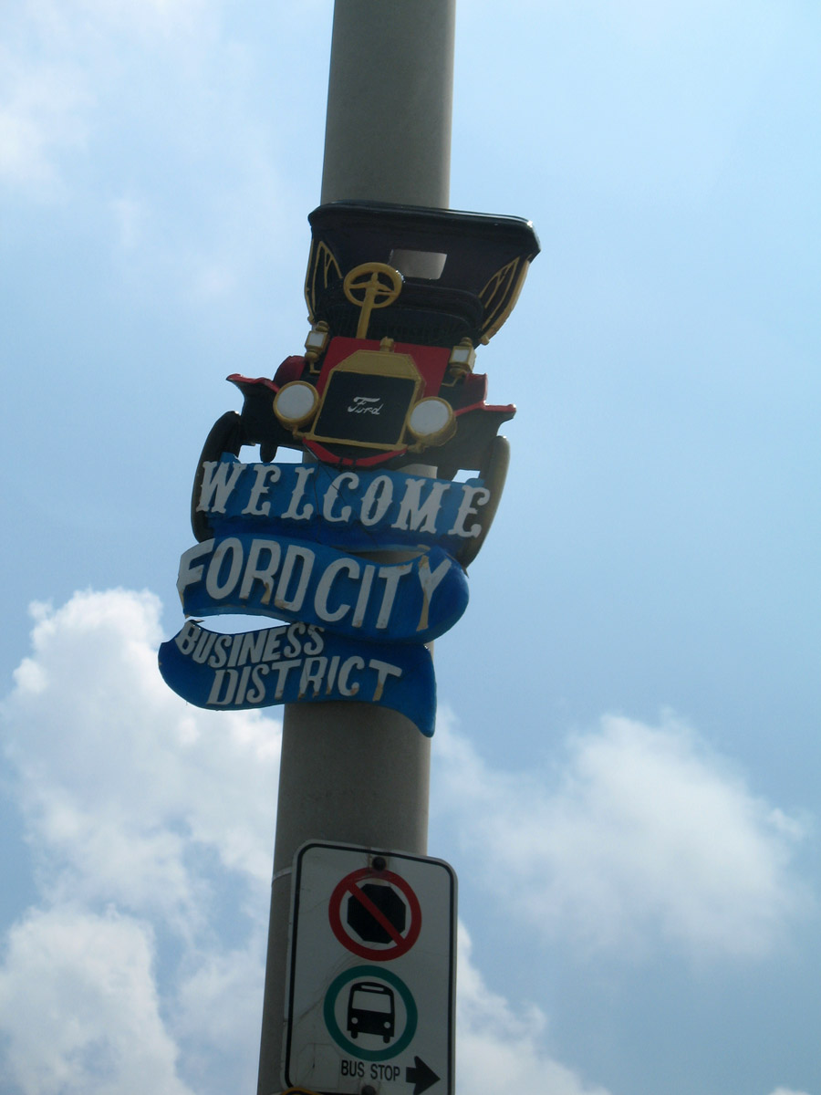
Ford City Business District sign on Drouillard Road
Ford City Business District, Drouillard Road. Jamie, CC BY 2.0, via Wikimedia Commons. Neighbourhood place image.

Read the chapter.

Ford Motor Co. of Canada plant, 1913
Ford Motor Co. of Canada plant, 1913. Windsor, Ontario, Canada, 1913, compiled by Harry Wentworth Gardner (Windsor: Evening Record, 1913), p. 84. Photographer uncredited. Public domain. Via Canadiana.ca / Wikimedia Commons.
Ford Motor plant from an aeroplane, Ford City
Ford Motor plant from an aeroplane, Ford City. Ford Motor Plant from an Aeroplane, Ford, Ont., about 1920. Canadian Postcard Company. British Library HS85/10/37671. Public domain.

Names on the Map

How the Border Cities became one city, and which heritage districts are real today. Walkerville is a Heritage Area with an HCD study in progress; it is not yet a Part V Heritage Conservation District.

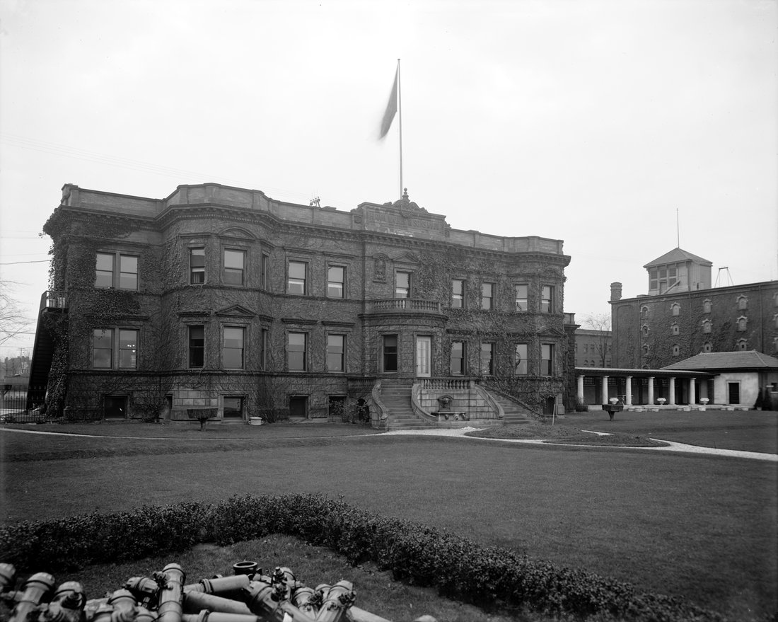
Walkerville office building, historic view
Walkerville distillery office building. Library of Congress / Commons. Public domain.

1935 amalgamation

City of Windsor (Amalgamation) Act, 1935 Names on the Map

Windsor, Sandwich, Walkerville and East Windsor (Ford City) became one city in 1935. Riverside was not part of that Act; Riverside and Ojibway joined in 1966. Walkerville voters had balloted heavily against amalgamation in December 1934; the provincial Act still proceeded amid Depression-era defaults.

Sources: City of Windsor History of Windsor · City of Windsor (Amalgamation) Act, 1935 materials · International Metropolis / Walkerville News figures as secondary
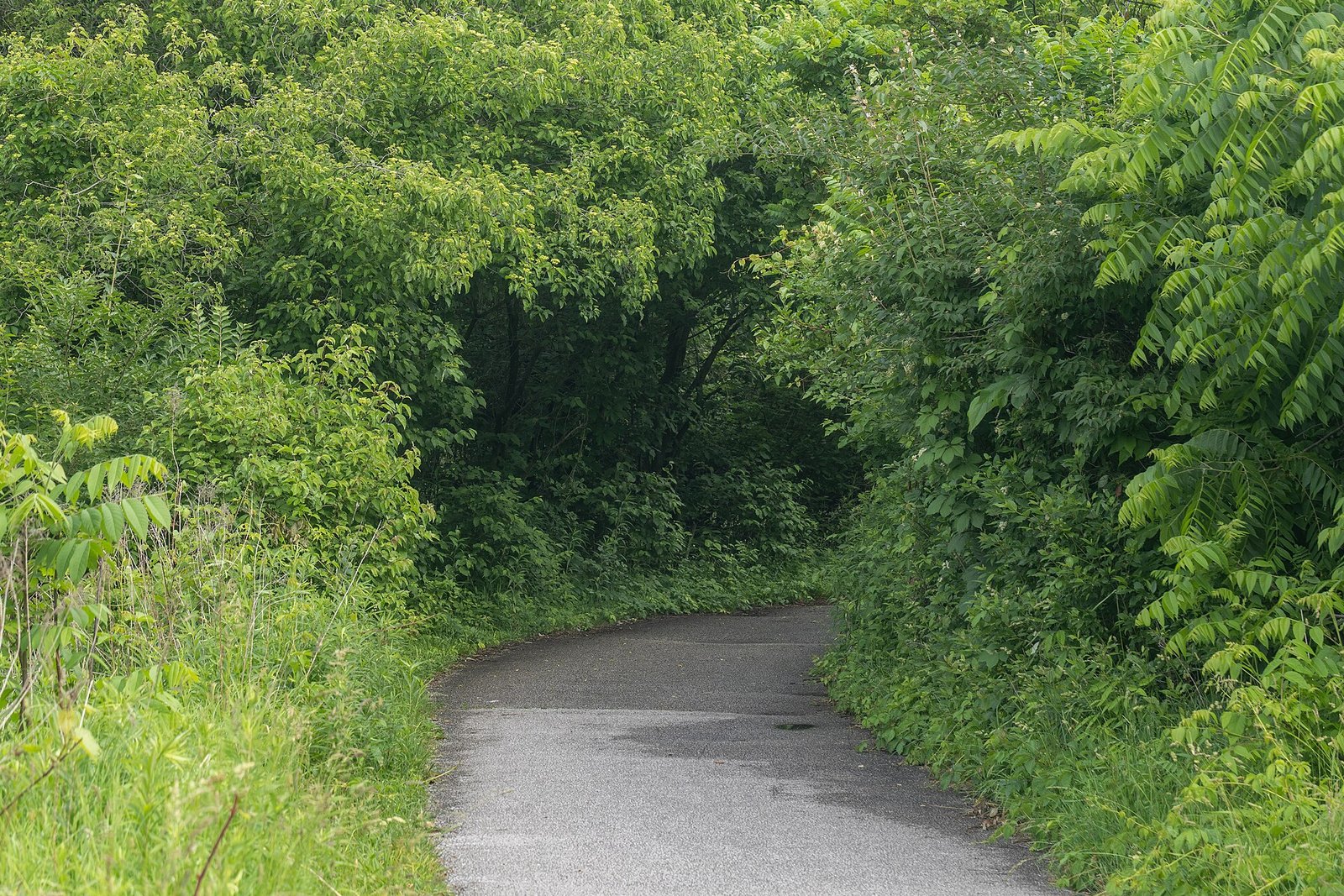
Ojibway Park, 14 June 2025
Ojibway Park, 14 June 2025. Ojibway joined Windsor in the 1966 annexation, with Riverside and parts of the Sandwich townships. This is the park today, not a period map. Photo: Chris Woodrich, CC BY-SA 4.0, via Wikimedia Commons.

1966 annexation

Riverside, Ojibway and parts of Sandwich townships Names on the Map

Riverside (town from 1921) and Ojibway joined Windsor in 1966, with parts of the Sandwich townships. A later Tecumseh-edge annexation adjusted the city boundary in 2003. Do not list Riverside among the 1935 partners.

Sources: City of Windsor History of Windsor · municipal boundary chronologies
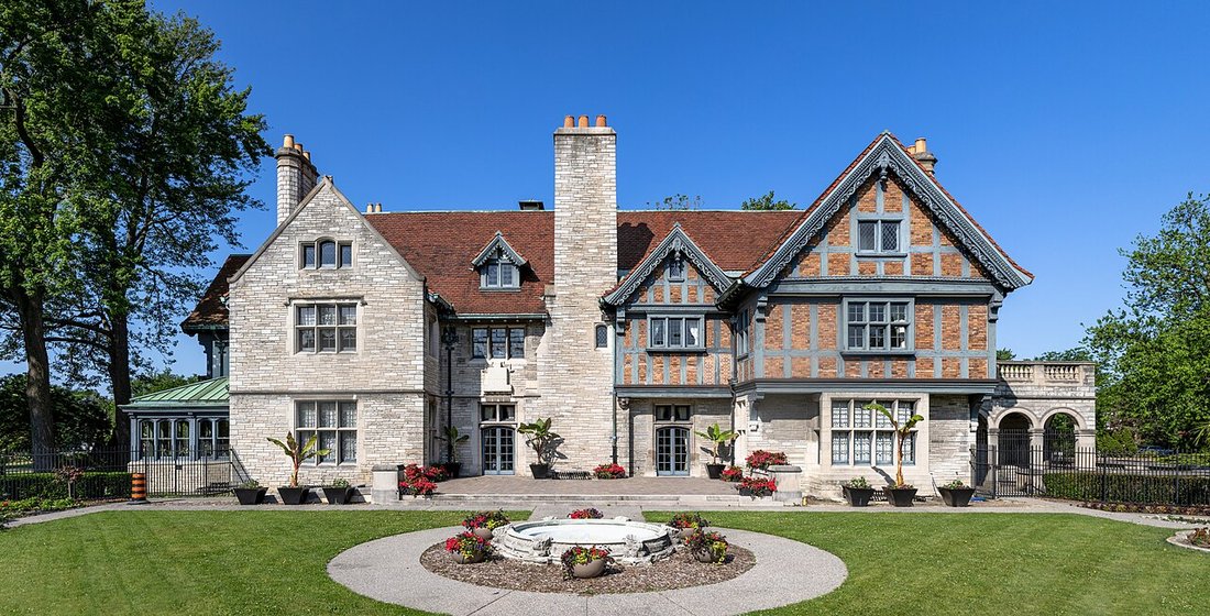
Willistead Manor, Walkerville, 2025
Crisco 1492. Willistead Manor, 10 June 2025. Wikimedia Commons. CC BY-SA 4.0. Walkerville landmark; not proof of HCD status.

Two Heritage Conservation Districts only

Prado Place HCD 2005; Sandwich HCD 19 October 2012 Names on the Map

Under the Ontario Heritage Act Part V, Windsor today has two HCDs: Prado Place (2005, first HCD; Riverside 200-block streetscape) and Sandwich / Olde Sandwich Towne (designated 19 October 2012). Walkerville is often called a heritage district in popular talk; legally it is a Heritage Area, with an HCD study under way (Stage 1 adopted 26 May 2025). Do not call Walkerville an HCD yet.

Sources: City of Windsor heritage designation pages · Walkerville HCD study / Let's Talk materials · Municipal Heritage Register
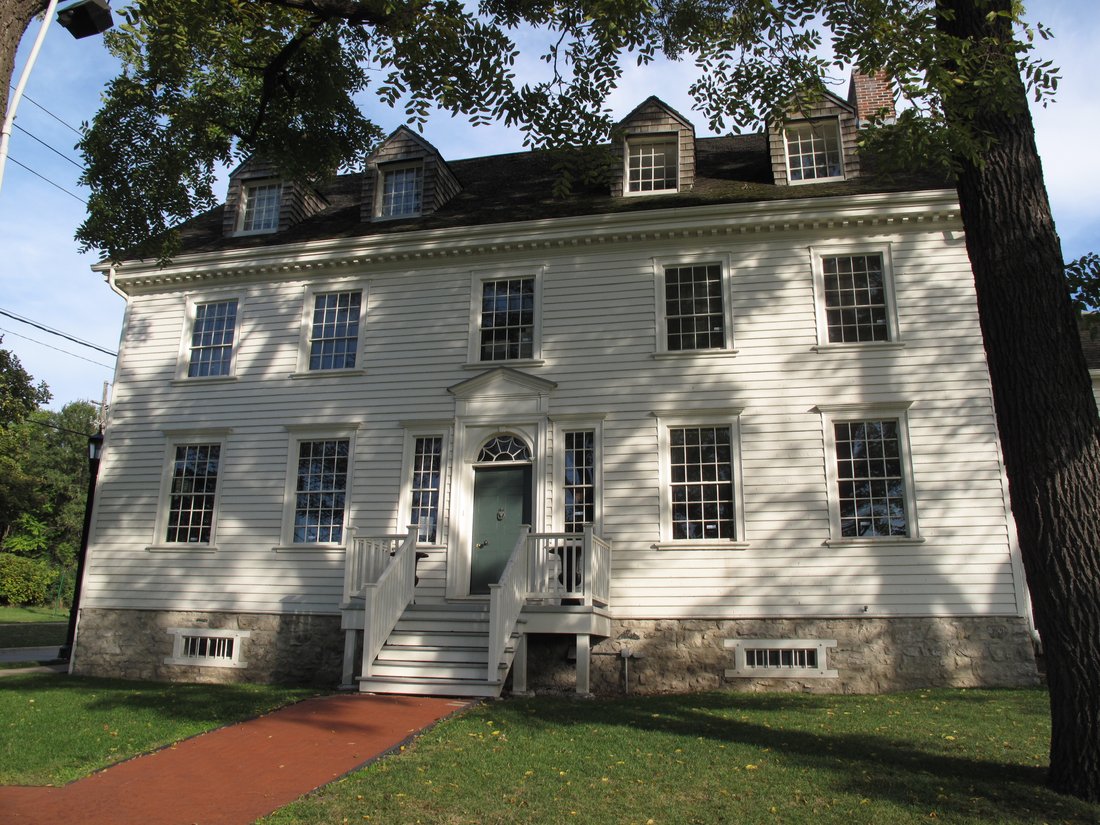
Duff-Baby House
LauraF84. Duff-Baby House, 2012. Wikimedia Commons. CC BY-SA 3.0.

Duff-Baby House (address note)

Built 1798; owned by Ontario Heritage Trust Sandwich landmark

Named for Alexander Duff and James Baby. Ontario Heritage Trust's property page lists 211 Mill Street; the City of Windsor museum page, HistoricPlaces.ca and the Trust's own James Baby plaque paper list 221 Mill Street. Until the Trust reconciles the listing, we note both and prefer 221 Mill for visitor directions (City / HistoricPlaces). Cross-link the Sandwich chapter for the full house story.

Sources: Ontario Heritage Trust property page (211) · City of Windsor (221) · HistoricPlaces.ca (221)

All chapters

Share a family photo or story

Have a photograph, a letter or a short family account from Windsor-Essex? Email a copy. Names, dates and places help. Keep your originals. We only publish with your permission, and we credit the family. Please do not send social insurance numbers, medical files or other private records.

Open an email to windsornewsdesk@gmail.com

If the button does not open mail, write us at windsornewsdesk@gmail.com with the same details. Nothing you type here is stored on this site. The fields only help fill the email on your device.