The river came first. Then the Three Fires, the farms, the ferries, the factories, and families.
For the Anishinaabe and Wyandot nations of the strait, and for every family who made Windsor home.
From the Strait to the Rose City: an 83-second montage of rights-cleared archival pictures with slow camera moves, captioned and credited in every shot. Gentle instrumental piano under the pictures (low level, short fade in and fade out). No colourizing, no AI imagery, no re-enactment. Sources and music rights are listed at the end of the film and on the credits page.
From the Archive: a sourced chapter story every month, starting with Nations of the Strait. Indigenous chapters invite community corrections; Walpole Island and Caldwell First Nations have not yet reviewed this first posting.
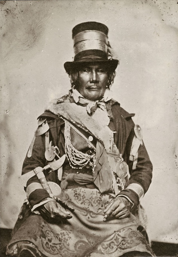
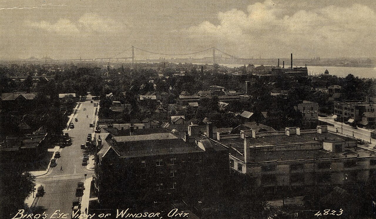
Ogimaa Oshawana of Bkejwanong (Walpole Island), 1858. Anishinaabe leader who fought beside Tecumseh at the Battle of the Thames, 5 October 1813. Photographed at the Grand General Council in Brantford, September 1858, wearing the medals, wampum and silver presented by the British and French governments. Photographer unknown. Library and Archives Canada, C-008543 / e010797042. Public domain. Source recordBird's Eye View of Windsor, Ont., about 1930. Real-photo postcard looking over Windsor's rooftops toward the new Ambassador Bridge (opened November 1929), with the Detroit River at right. Peerless Specialty Co., postmarked 28 August 1930. Public domain. Via Wikimedia Commons. Source record
The Timeline
Local stories
Galleries
Art of the Rose City
Posters, prints and maps from Windsor's past, free to download and print, and the work of living Indigenous artists, shown with their permission, with links to buy from them directly.
Free printable
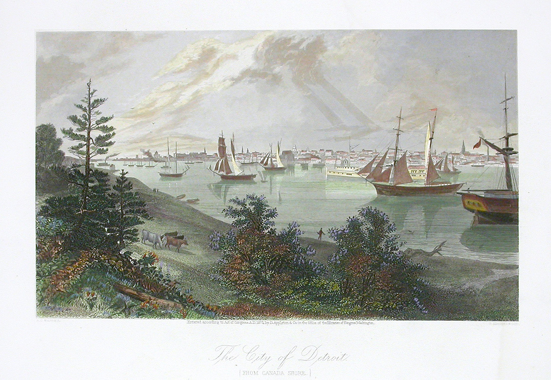
Detroit from the Canada Shore, 1872Steel engraving from Picturesque America (D. Appleton, 1872), the view from the Windsor side of the river. Public domain.
Free printable
"Off to Canada," about 1935Detroit-Windsor Tunnel postcard. CC0.
Free printable
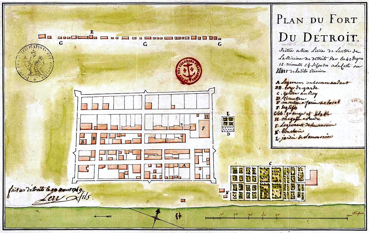
Plan du fort Détroit, 1749Gaspard-Joseph Chaussegros de Léry. Public domain.
Free printable
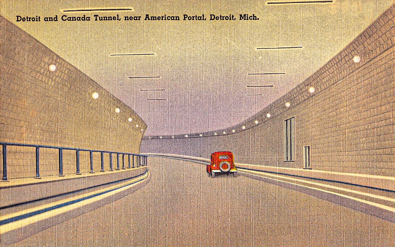
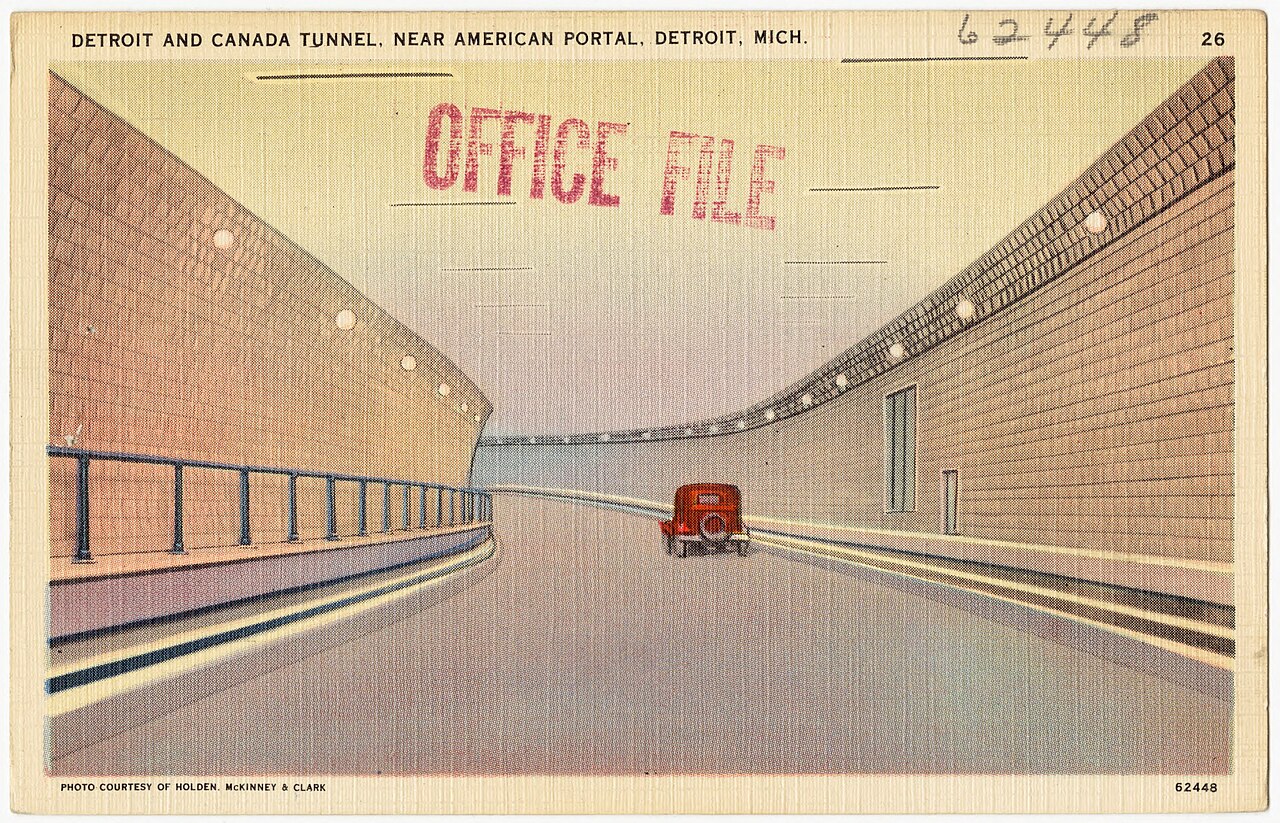
Detroit and Canada TunnelTichnor Bros. postcard, 1930s. Public domain.
Free printable
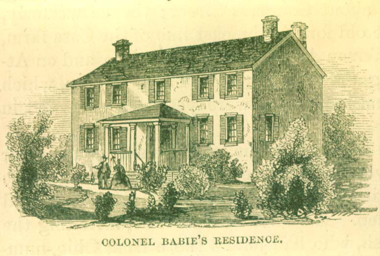
The Baby House, SandwichEngraving, Lossing, Pictorial Field-Book of the War of 1812, 1868. Public domain.
Free printable
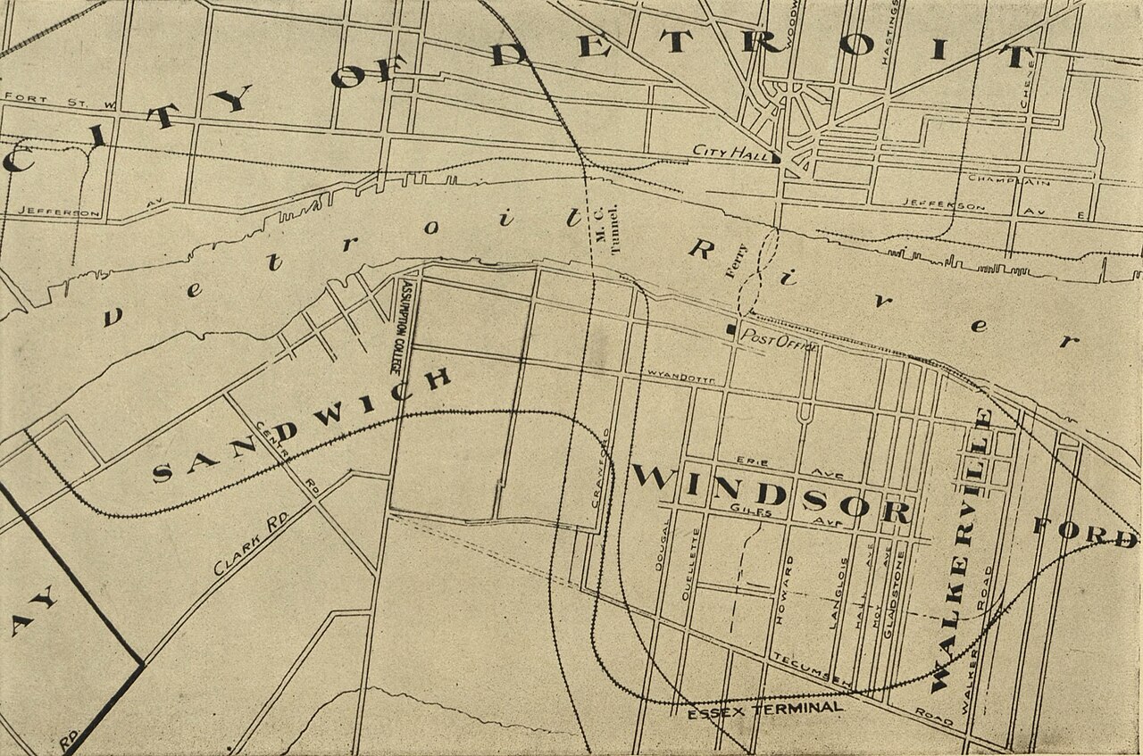
Map of Windsor and environs, 1913Gardner, p. 2. Public domain.
Free printable
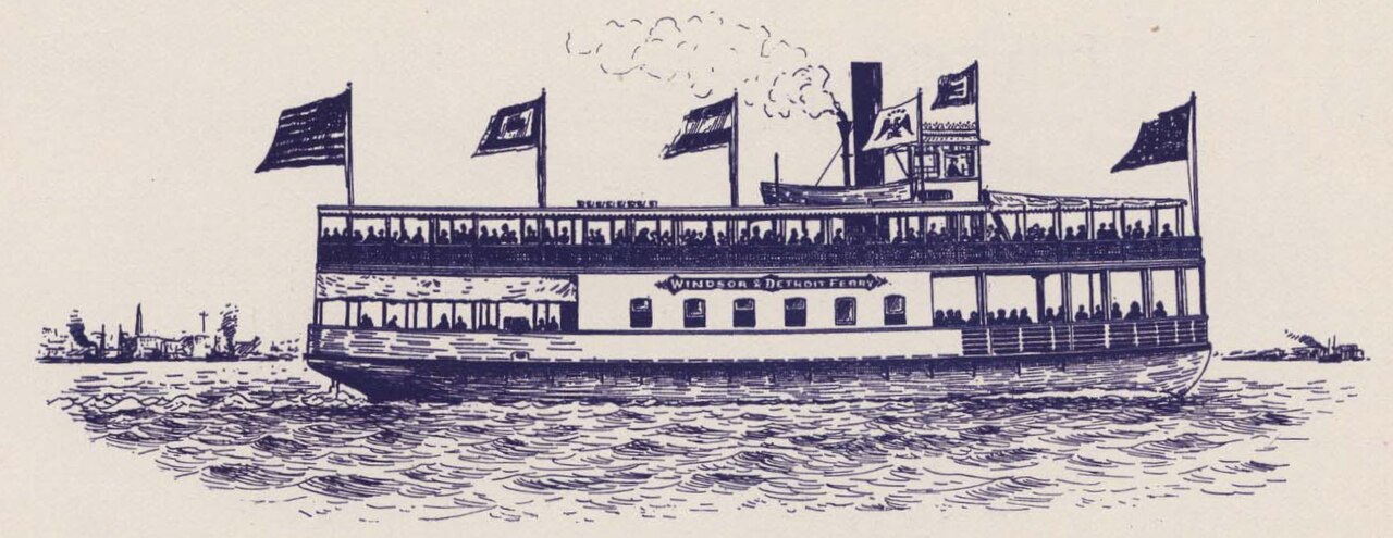
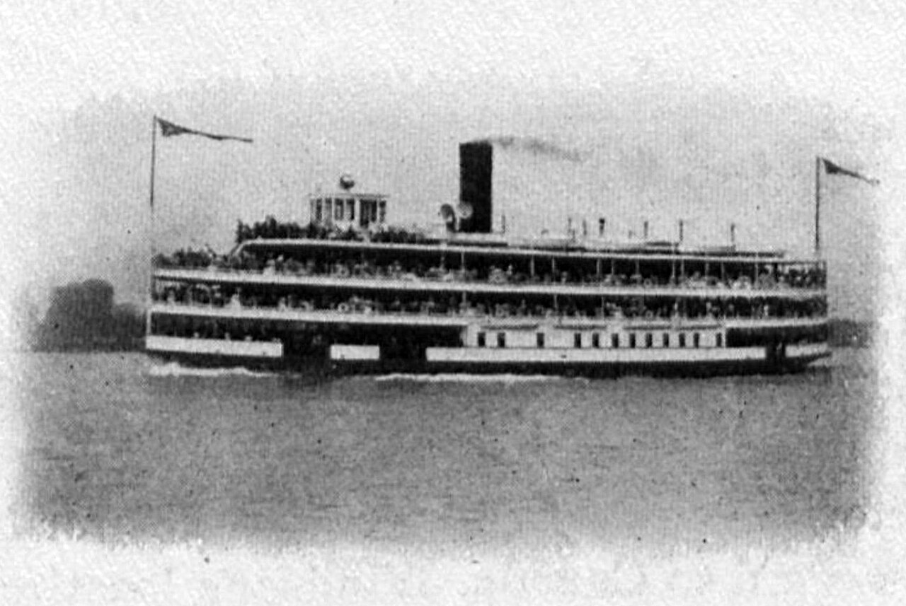
Steamboat Excelsior, 1895Detroit River excursion boat. Public domain.
Living Indigenous artists of Bkejwanong, Caldwell and Windsor
Artists are featured only with their permission, in their own words, with a link to buy from them directly. Windsor News takes no cut. We never copy designs or show non-Indigenous work as Indigenous.
Stand-in until the artist says yes
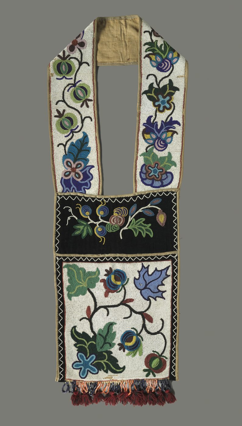
Walpole Island (Bkejwanong) artist: place held by a museum piece, Anishinaabe (Ojibwe) bandolier bag, Great Lakes region, 1880s, maker not recorded. Not by a living artist of this community. CC0.
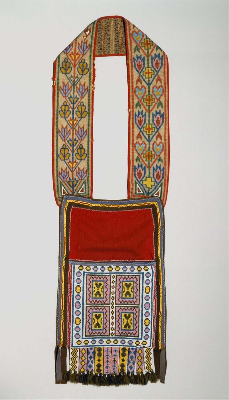
Caldwell First Nation artist: place held by a museum piece, Ojibwa bandolier bag, about 1870, maker not recorded. Not by a living artist of this community. CC0.
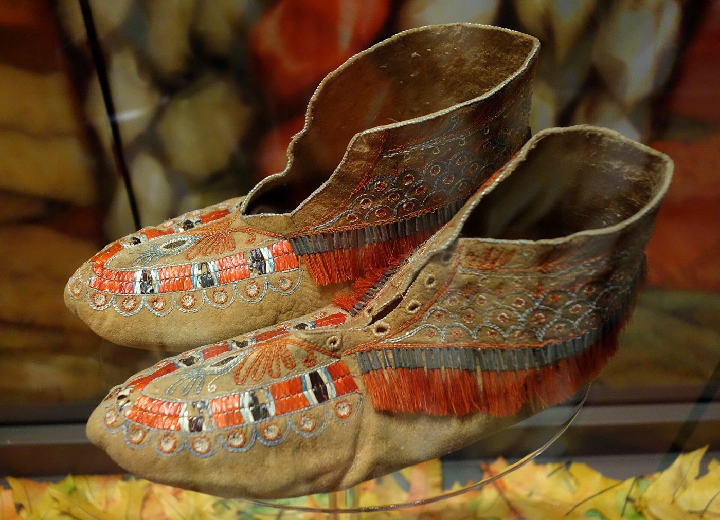
Windsor urban Indigenous artist: place held by a museum piece, Huron moccasins with quillwork and moose hair, 1780 to 1830, maker not recorded. Not by a living artist of this community. CC0.
Line-art pages made from public-domain postcards and maps. Print at home or in class.
Ouellette Avenue
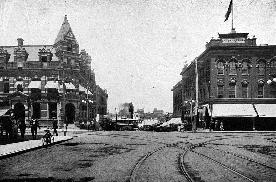
Then: Ouellette Avenue looking north from Sandwich Street, 1913. Harry Wentworth Gardner, Windsor, Ontario, Canada, 1913 (Evening Record), p. 13. Photographer uncredited. Public domain, via Canadiana.ca / Wikimedia Commons.
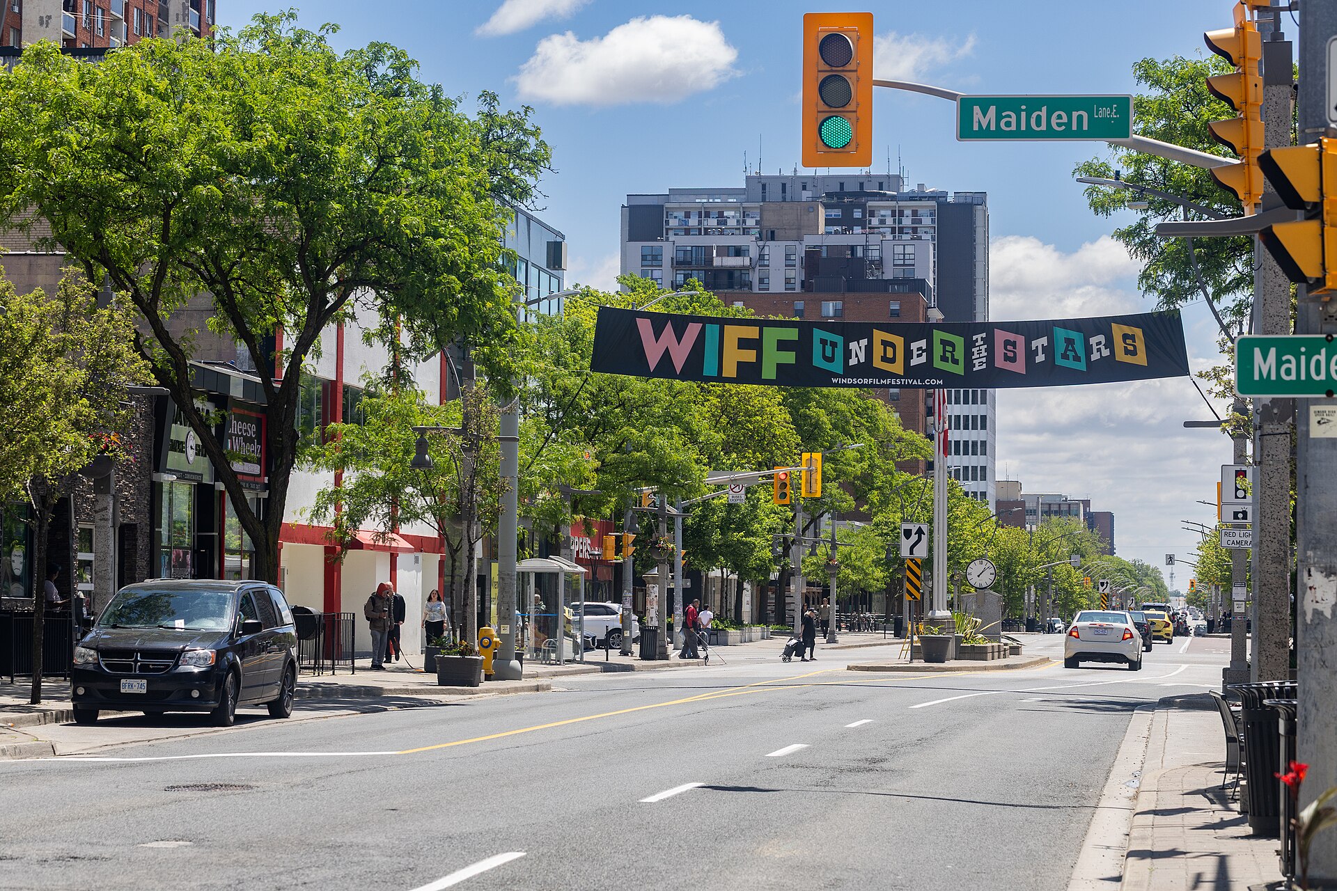
Later: Ouellette Avenue at Maiden Lane, 31 May 2025. Crisco 1492, CC BY-SA 4.0, via Wikimedia Commons. This is the same street, a downtown block near the river. We have not confirmed it is the same camera position as the 1913 view from Sandwich Street.
Tap a rose pin on the 1913 map to open the story and photos for that place.
Nations of the Strait
The Anishinaabe Three Fires (Ojibwe, Odawa, Potawatomi) and the Wyandot lived on both shores of the river long before Windsor. Their history runs through every chapter, and it is not over.
1721 to 1760s. Odawa and Wyandot villages stand on the south shore, opposite the French fort (City of Windsor Archaeological Management Plan).
1763. About 250 warriors from the Odawa village join Obwandiyag (Pontiac) in the siege of Detroit (Siege of Detroit plaque, Riverside Drive).
1 May 1788. Thomas McKee takes a 999-year lease on Pelee Island, the island in Lake Erie, for three bushels of corn a year. Walpole Island's 1869 Memorial says the island was leased, never ceded. (Pelee Island is not Point Pelee; see the 1920s.)
19 May 1790. McKee's Purchase. Two reserves set apart, at Anderdon and beside the Huron Church. Caldwell's chiefs did not sign.
2 June 1797. Alexander McKee goes to Walpole Island to buy the Huron Church Reserve from "the proper owners of the soil"; 61 acres beside the church are kept as a camping ground for Walpole Island people.
11 September 1800. Deed No. 12. The 1,078-acre Huron Church Reserve is sold to the Crown for £300 in goods (blankets, kettles, cloth, tools, ammunition, a bullock). The same deed takes 1,334 acres by the Amherstburg garrison and a 41-acre road as a "gift": 1,375 acres, which the deed rounds to "1,380 or thereabouts". In all, 2,412 acres and a road, as the official treaty index records. Witnessed by commissioners F. Baby and Alexander Duff. Roundhead (Ustaiechta), later Tecumseh's ally, is among the chiefs who signed.
1812 to 1813. Tecumseh in council at Sandwich, 7 July 1812; killed at Moraviantown, 5 October 1813.
1837 and 1841. Potawatomi and Odawa families return from Michigan and settle at Bkejwanong, the dates given by the Nation itself in its 1869 Memorial. Walpole Island was never surrendered.
1851 to 1946. Children from Walpole Island are sent to Mount Elgin, Shingwauk, the Mohawk Institute and other residential schools. Walpole Island's memorial monument carries about 400 survivors' names.
19 July 1853. Wyandot chiefs at Anderdon sign away the camping ground, a triangle "commencing on Detroit street and running along the River Detroit to the Huron church line" (Surrender No. 71); the Three Fires were not party to it. The Ambassador Bridge (1929) lands on that ground, Walpole Island's research shows.
1920s. Caldwell families are pushed out of the new Point Pelee National Park (1918), on the mainland. Caldwell First Nation's own account, as reported by CBC, is that families were burned out of their homes "by the RCMP" in the 1920s. The claim is settled for $105 million (members' vote August 2010, announced March 2011); reserve status for 80 hectares at Leamington, November 2020.
Today. A "do not consume" water advisory at Walpole Island after a St. Clair River spill (March 2025); Walpole Island's $46 million Enniskillen claim vote, delayed in 2024; Red Dress Day at the Can-Am Friendship Centre every 5 May.
Drawn from published primary and authoritative sources. Walpole Island and Caldwell First Nations have not yet reviewed this chapter. If something needs correcting, email windsornewsdesk@gmail.com. More community voices and art are coming.
Freighters on the St. Clair River opposite Walpole Island (Bkejwanong). The view is from the American shore looking across to Canada. Walpole Island First Nation is on the far shore. U.S. Army Corps of Engineers. Public domain. Via Wikimedia Commons.
New connections from the documents
Original findings from our own reading of the primary records. Each one says how strong it is. None of them is a claim of wrongdoing.
NEW CONNECTION · THE WINDMILL ON THE LINE
Deed No. 12 ends the reserve's upriver line at a creek "about one hundred and fifty-seven yards above a wind-mill belonging or lately belonging to Messieurs Baby", and the deed's sketch marks "Baby's Mill" at that corner. A 1799 Executive Council minute shows the mill was James Baby's, standing "opposite to the Town". The deed was witnessed by "F. Baby" and Alexander Duff as Commissioners for Upper Canada; Thomas McKee accepted it for the King.
How strong: all from primary records (Indian Treaties and Surrenders, vol. 1, pp. 30 to 31; the 1799 minute printed by Lajeunesse, 1960). F. Baby is probably François Baby, James's brother, but the deed does not say so. Read the deed
NEW CONNECTION · LOTS BEFORE THE DEED
The Sandwich town lots were drawn in 1797, three years before the land was surrendered. The lot list approved at Newark on 14 August 1797 includes the McKees, Francis Baby, James Baby, Alexander Duff, John Martin, Prideaux Selby and Richard Pollard. The 1800 deed was accepted by T. McKee, witnessed by F. Baby, Alexander Duff and a John Martin, and registered by P. Selby and Richard Pollard. Duff's house on lot 5, today the Duff-Baby House, was certified built on 9 July 1798.
How strong: a documented overlap of names in two primary records, both printed by Lajeunesse (1960). We have not found it tabulated anywhere else. It shows who was in the room; it does not show wrongdoing. There may have been two men named John Martin. Lajeunesse, The Windsor Border Region
NEW CONNECTION · MILL, STREET, CAMPING GROUND, BRIDGE
Follow one line through four records. The 1800 boundary runs near the Baby mill. The mill stood opposite the town, which was laid out from Detroit Street. The 1853 surrender of the camping ground begins "on Detroit street". Walpole Island's research places the Ambassador Bridge's landing in that ground. Today a 1992 replica windmill stands at Russell and Mill Streets.
How strong: each link is in a primary record or the Nation's own research; the chain is ours. Locations are approximate, so we say "near": none of these sources maps the spots exactly. The Sandwich windmill
NEW CONNECTION · WITNESS TO BOTH
"Frans. Baby, Ensg. Militia" witnessed the 1790 treaty that set the Huron Church Reserve aside. "F. Baby, Commissioner" witnessed the 1800 deed that took it. Very likely the same man, François Baby, whose house is now Museum Windsor's François Baby House. Another 1800 witness, "L. R. C. de Lery, Capt.", was Louis-René Chaussegros de Léry, son of the engineer who surveyed Detroit in 1749.
How strong: the signatures are primary (Treaty No. 2 and Deed No. 12). That both F. Babys are François is likely, not proven. The de Léry family link is from the Dictionary of Canadian Biography. Read the 1790 treaty
Photos by chapter: Rails, Ferries and Crossings
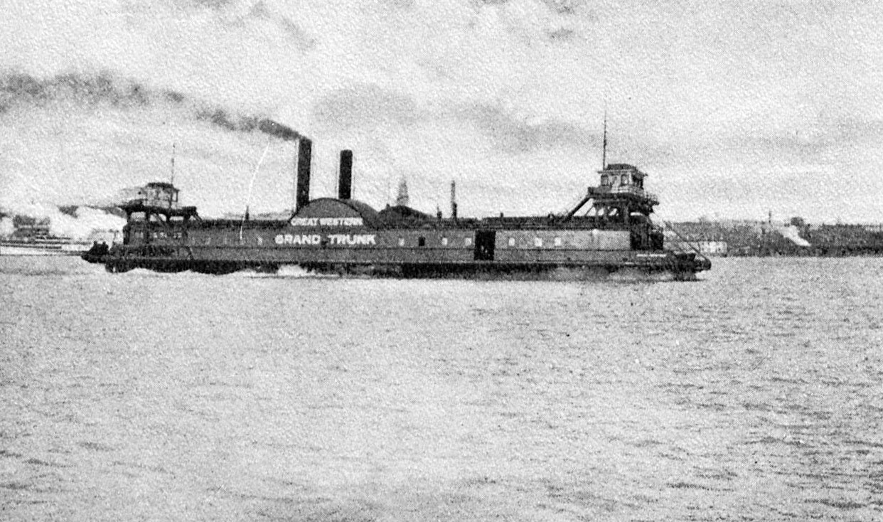
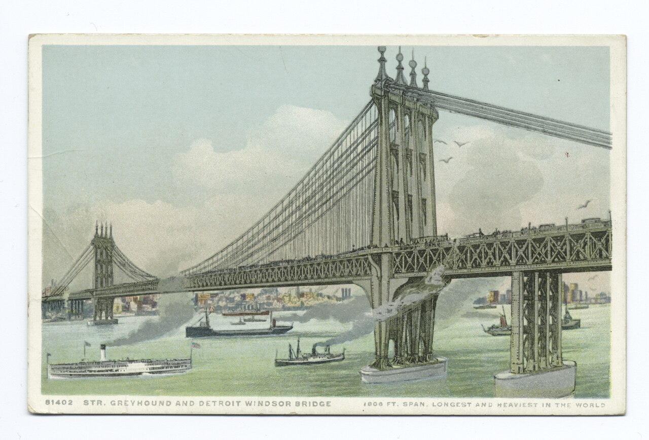
Ferry, Windsor, 1913. Gardner p. 4. Public domain.Car ferry Transport, 1913. Gardner p. 20. Public domain.The bridge that was never built, about 1920. Charles Evan Fowler's proposed Detroit-Windsor bridge, "1803 ft. span". Detroit Publishing Co. postcard 81402. NYPL. Public domain."Off to Canada," about 1935. CC0.
Chapter clip (planned): 30 seconds, ferries to tunnel, from the cleared photos above plus public-domain footage. Not produced yet.
Photos by chapter: The French Shore
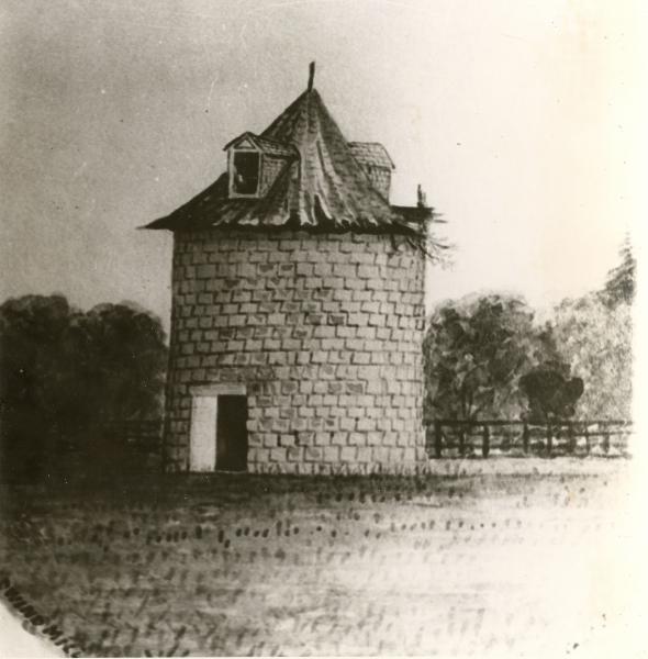
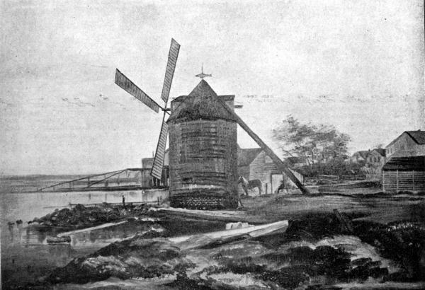
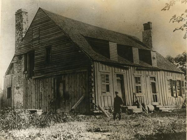
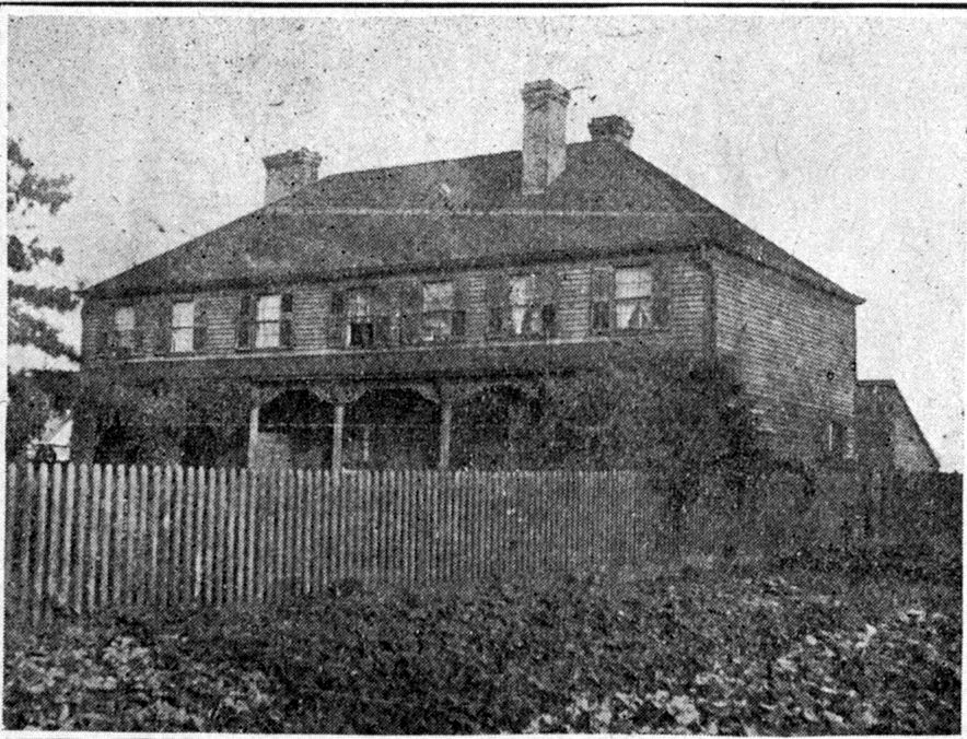
Windmill, Petite Côte. Built 1803; watercolour by James Van Cleve, 1881, in Neal, The Township of Sandwich (1909). SWODA. Public domain.Montreuil windmill, Sandwich East. Built 1815, ran to 1852. Neal (1909), p. 54. SWODA. Public domain.Huron Mission House, about 1895. Opposite Assumption Church. Walkerville Times Collection, SWODA. Public domain.Moy House. Built 1799 by Angus Mackintosh, demolished 1912. Neal (1909), p. 8. SWODA. Public domain.
James Van Cleve, who painted the river's windmills, bought the Duff-Baby House in 1879.
Photos by chapter: Rum Row
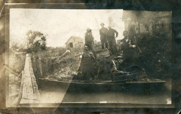
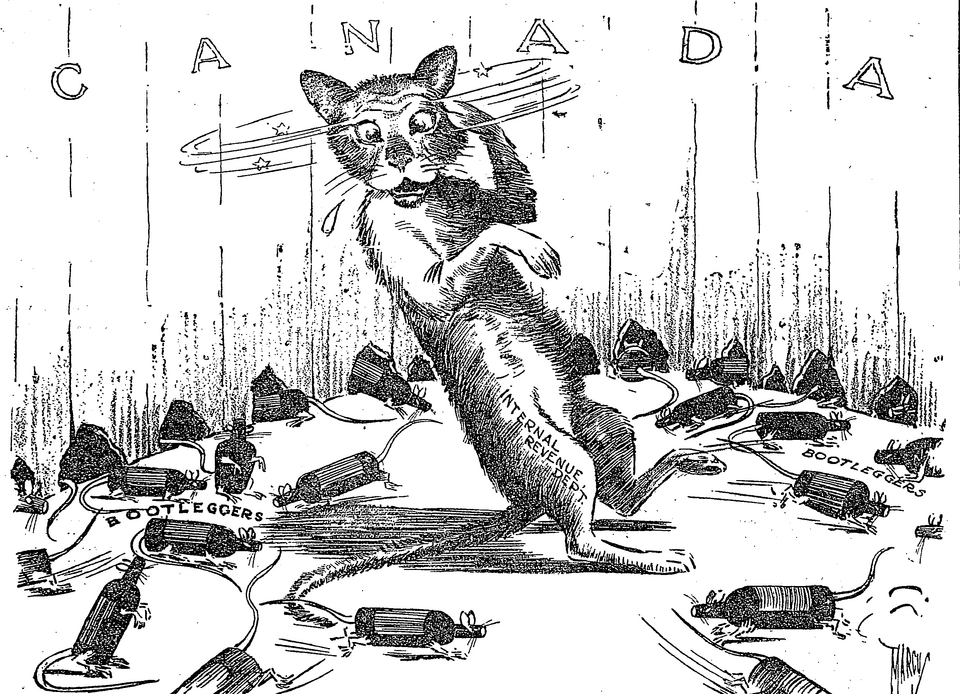
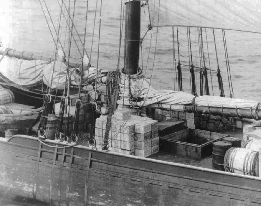
Smuggling on Pike Creek, about 1925. Pike Creek is in Lakeshore, Essex County, not Windsor. Donated by Chris Baillargeon. SWODA. Public domain."Too Many Holes to Watch," 1923. Edwin Marcus, The New York Times, on the border talks over smuggling. Public domain.Stand-inRum runner sloop, 13 January 1924. U.S. Coast Guard photo. Public domain. Not the Detroit River as far as the record shows; holds the place for two Reuther Library photographs on order.
History only: smuggling, enforcement and its cost along the river, never a celebration. Two Reuther Library photographs (Detroit News negatives 27833 and 27841) are on order; until they arrive, a 1924 U.S. Coast Guard photograph stands in, marked as a stand-in. Read the Rum Row chapter.
Still to come: living Indigenous artists' own work (cleared museum stand-ins hold their places until each artist says yes), the Reuther Library photographs on order, and more neighbourhood stories.
Emancipation Day at Jackson Park: Walter Perry began organizing Windsor celebrations about 1932 (Windsor Public Library; CBC). The large Jackson Park festivities ran from 1935 to 1966 (University of Windsor Scholaris program collection; City of Windsor Emancipation Celebration Monument). The 1967 celebration was cancelled after the Detroit uprising; Perry died that year. We do not collapse those into one 1932 to 1967 Jackson Park range. Read the full Jackson Park story.
Share a family photo or story
Have a photograph, a letter or a short family account from Windsor-Essex? Email a copy. Names, dates and places help. Keep your originals. We only publish with your permission, and we credit the family. Please do not send social insurance numbers, medical files or other private records.
If the button does not open mail, write us at windsornewsdesk@gmail.com with the same details. Nothing you type here is stored on this site. The fields only help fill the email on your device.

 Donate to Museum Windsor