The land and water that still hold us: tallgrass inside the city, a Carolinian tip into Lake Erie, a Heritage River and flyway, marshes and a hawk watch kept by volunteers, woods and a little river neighbours restore. Verified from parks, conservation and heritage sources; gaps stay labelled.
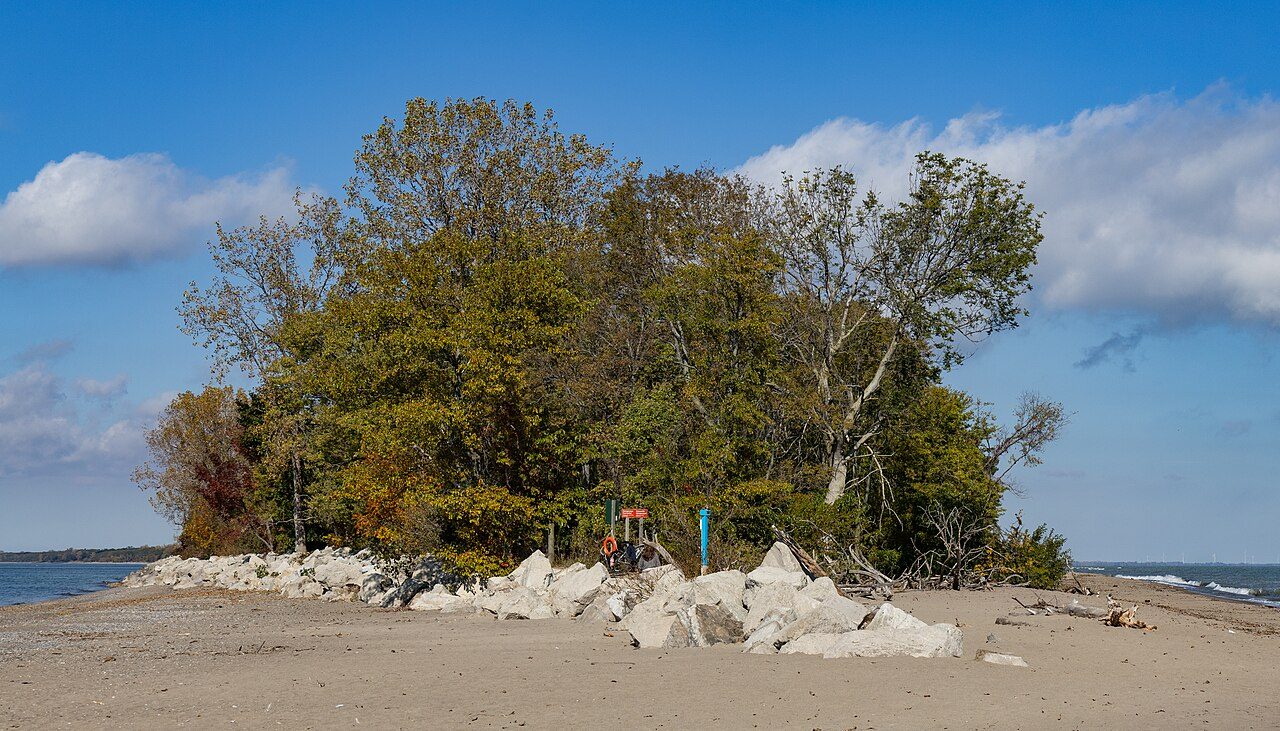
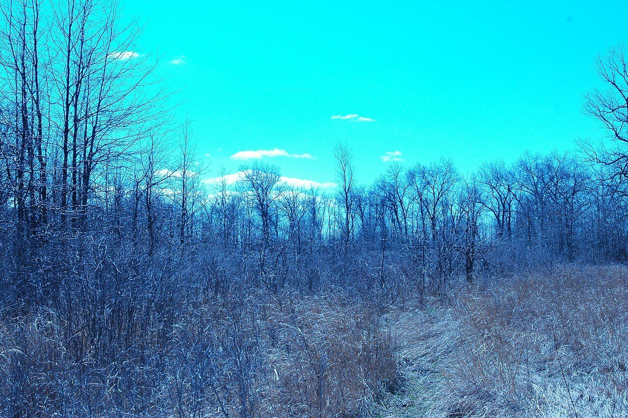
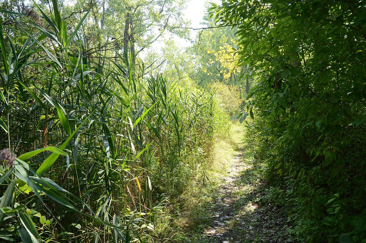
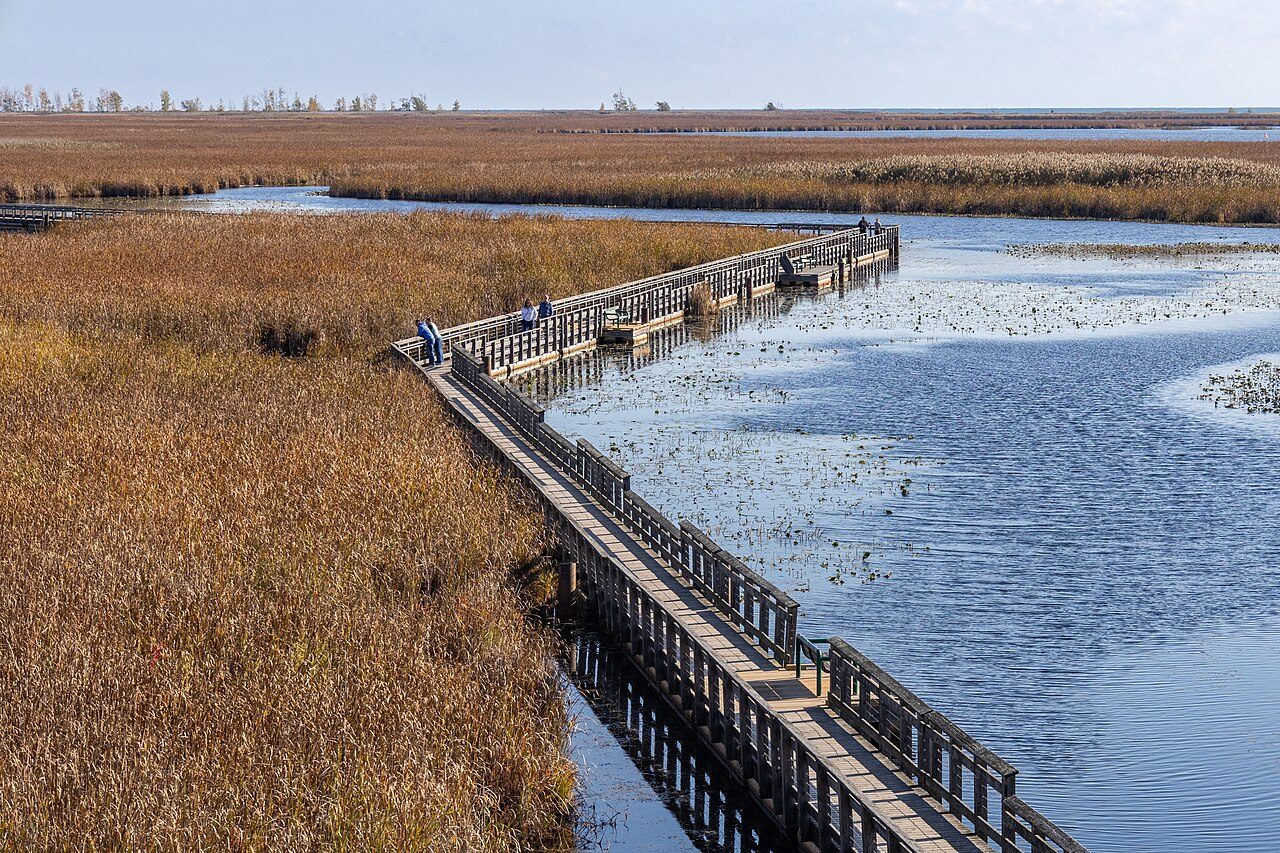
Ojibway Prairie, Windsor. Mark Nenadov, 6 Apr 2016. Wikimedia Commons. CC BY 2.0. Cross-link the short card on City and Society.The Tip, Point Pelee National Park. Chris Woodrich, 24 Oct 2026. Wikimedia Commons. CC BY-SA 4.0.
Tallgrass and oak savanna
Ontario's largest protected prairie remnant sits inside Windsor. City and Society holds the short card; we open the complex here.
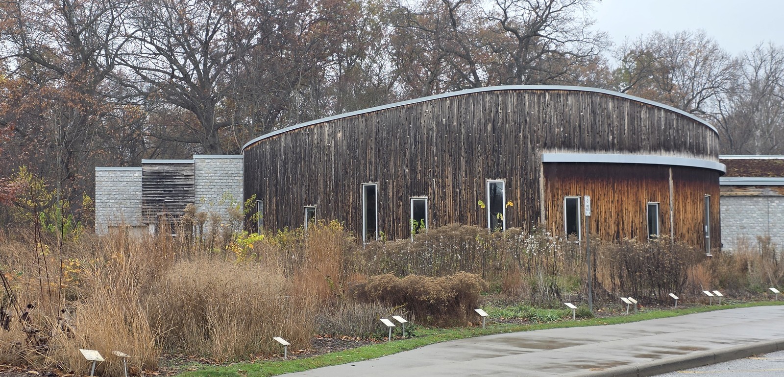
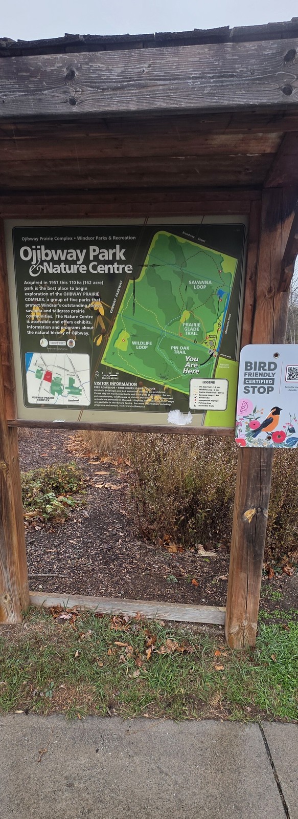
Ojibway Nature Centre, 12 November 2026.Photo by Kyle L. Stewart, Windsor NewsOjibway Park map kiosk, 12 November 2026.Photo by Kyle L. Stewart, Windsor News
Free to use
Ojibway Prairie Complex
Tallgrass prairie and oak savanna inside Windsor; Nature Reserve est. 1977
Ontario Parks: Ojibway Prairie Provincial Nature Reserve is 64.12 ha, established 1977 as a Nature Reserve inside Windsor. Native prairie, savanna and open woodland; more than 500 flowering plants nearby, about 18 percent rare in Ontario. City Parks: the municipal complex (Ojibway Park, Tallgrass Prairie Heritage Park, Black Oak Heritage Park, Spring Garden, Oakwood) is about 260 ha, with the provincial reserve adding more prairie and savanna. City Nature Centre: free admission and trail access. Cross-link the short Ojibway Prairie card on City and Society (who's-missing add). Keep Nations of the Strait for treaty and Nation politics; this tab tells the ecology people can still walk. The steel-town plan of 1913 that never came (Ojibway incorporated 1913, annexed 1966) lives in research notes; woods grew where streets were drawn.
Sources: Ontario Parks Ojibway Prairie page; City of Windsor Ojibway Prairie Complex and Nature Centre pages; OEB EB-2007-0800 (annexation date)
Mark Nenadov. Ojibway Prairie (Windsor, Ontario), 6 Apr 2016. Wikimedia Commons. CC BY 2.0.
Free to use
Tallgrass Prairie Heritage Park
Municipal prairie beside the provincial Nature Reserve
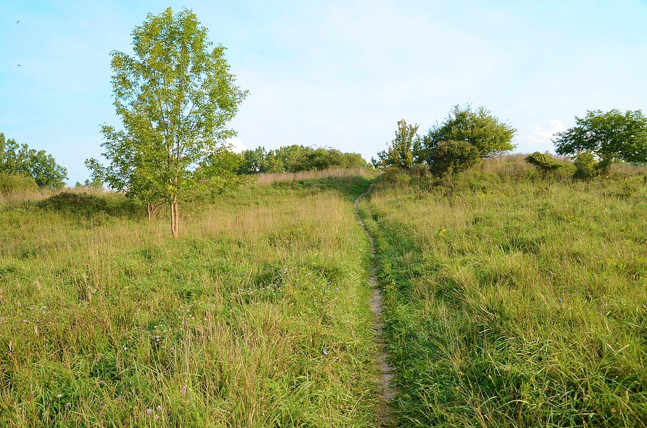
Part of the City-run complex next to the Ontario Parks reserve. Same tallgrass story, city trails and steward work. Free Commons photo by Mark Nenadov shows the municipal heritage park in late summer.
Sources: City of Windsor Ojibway Prairie Complex; Commons photograph
Mark Nenadov. Tallgrass Prairie Heritage Park, 6 Sep 2016. Wikimedia Commons. CC BY 2.0.
Free to use
Ojibway in late winter
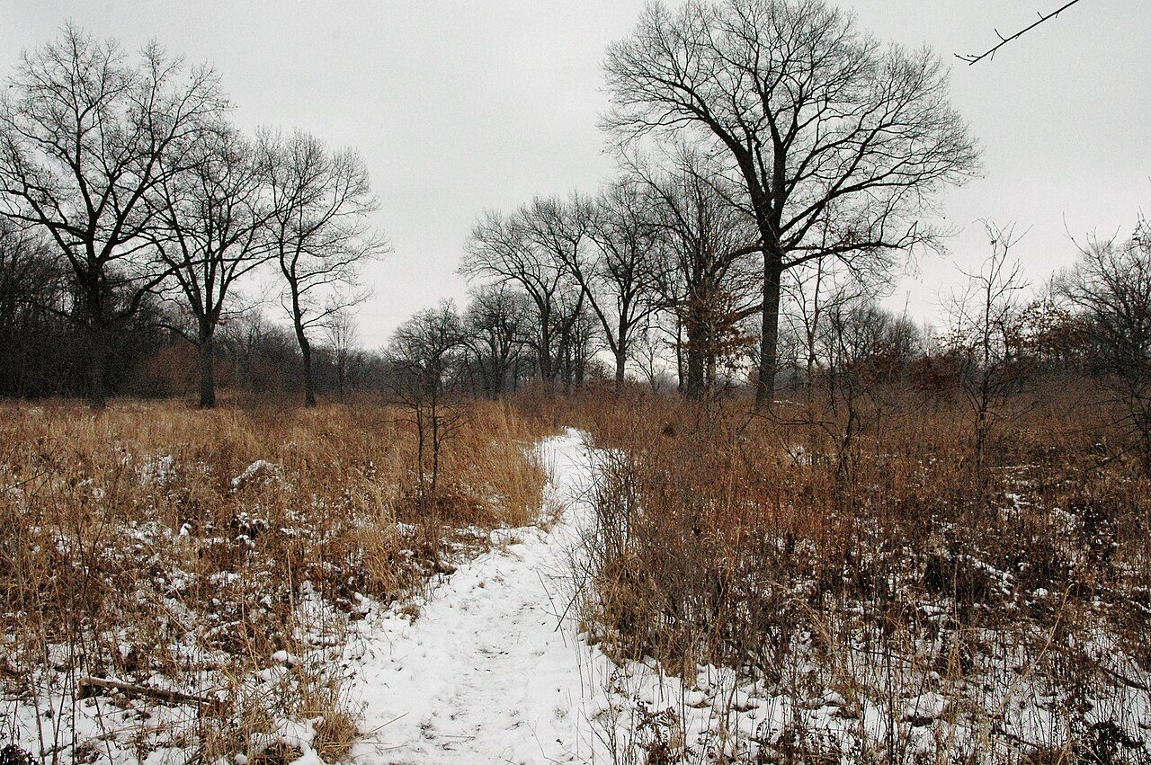
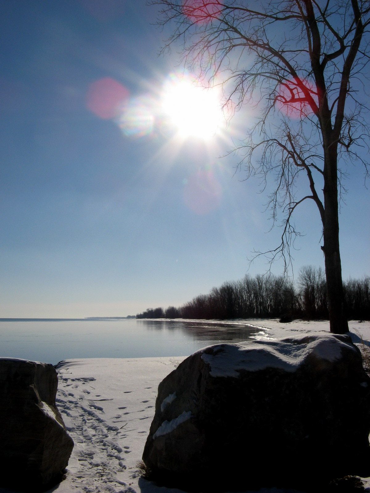
Prairie under snow, Feb 2015
The same rare habitat in a quieter season. Kept as a second free view so readers see the prairie is year-round land, not only a summer postcard.
Sources: Commons photograph; Ontario Parks habitat description
Mark Nenadov. Ojibway Prairie in Late Winter, 16 Feb 2015. Wikimedia Commons. CC BY 2.0.
Carolinian shore
Point Pelee National Park is Essex County's southern door to Carolinian Canada and one of inland North America's great migrant traps.
Free to use
Point Pelee National Park
Est. 1918; mainland Canada's southern tip; Carolinian zone
Parks Canada and the Canadian Encyclopedia: Point Pelee National Park protects the tip of the peninsula into western Lake Erie, south of Leamington. Established 1918; Middle Island added 2000. Carolinian (deciduous forest) zone and a large marsh that is a Ramsar wetland. More than 390 bird species recorded in the birding area; 43 of Canada's 52 warbler species have been seen here. Spring and fall songbird and monarch migrations funnel over the Tip. Essex County's Carolinian story starts here for many visitors; Windsor's prairie and river complete the county picture.
Sources: Parks Canada Point Pelee (habitats, migration); Canadian Encyclopedia Point Pelee National Park
Chris Woodrich. Tip, Point Pelee National Park, 24 Oct 2026. Wikimedia Commons. CC BY-SA 4.0.
Free to use
Marsh Boardwalk and Carolinian marker
Marsh habitat and the Carolinian Canada story at the Tip
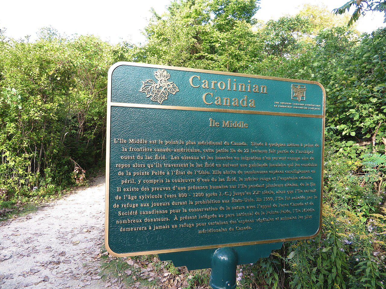
Parks Canada lists five main habitats at Pelee, including marsh and swamp forest. The Carolinian Canada marker at the Tip is a free photo that names the zone without claiming species we have not verified from a primary list tonight.
Sources: Parks Canada ecosystems page; Commons photographs
Marsh boardwalk: Chris Woodrich, 24 Oct 2026, CC BY-SA 4.0. Carolinian marker: Ken Lund, 27 Sep 2015, CC BY-SA 2.0. Via Wikimedia Commons.
Detroit River
A Canadian Heritage River (2001), a shared flyway, and Peche Island as a public habitat in the stream.
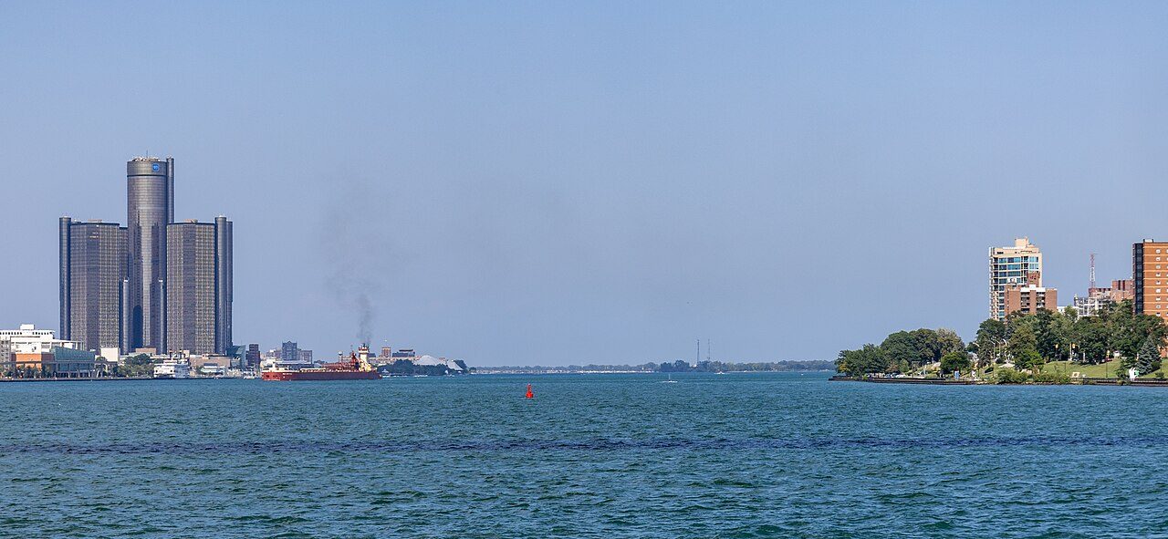
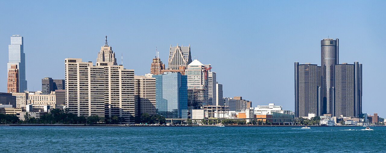
Detroit River from Windsor. Chris Woodrich, 27 Jul 2025. Wikimedia Commons. CC BY-SA 4.0. Canadian Heritage River (2001) and a shared flyway.
North Beach, Hillman Marsh. Andrea_44, 9 Jan 2011. Wikimedia Commons. CC BY 2.0.Spring Garden trail. Mark Nenadov, 6 Sep 2016. Wikimedia Commons. CC BY 2.0.
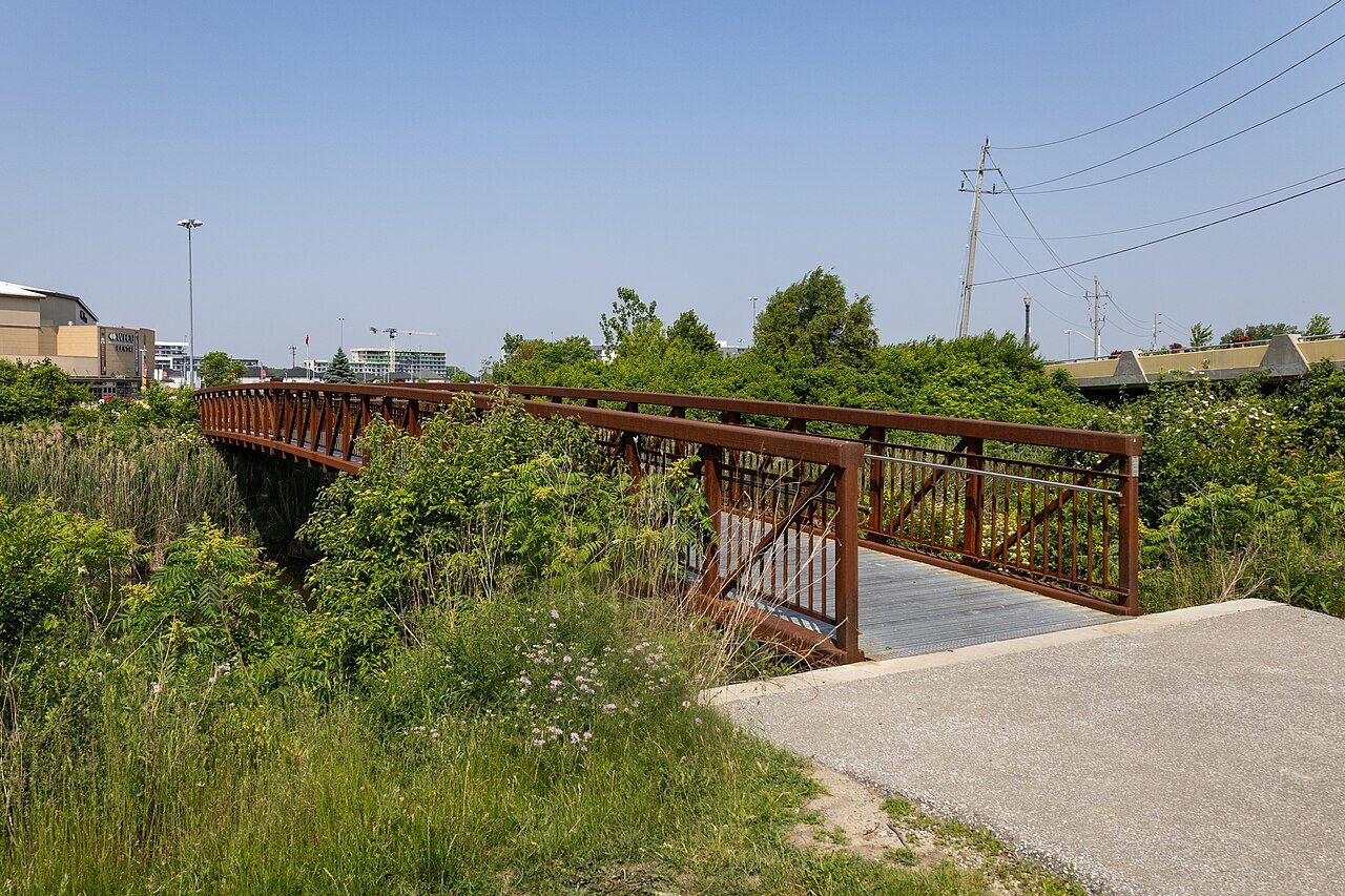
Carolinian Canada marker, Point Pelee Tip. Ken Lund, 27 Sep 2015. Wikimedia Commons. CC BY-SA 2.0.McHugh Bridge over Little River. Crisco 1492, 11 Jun 2025. Wikimedia Commons. CC BY-SA 4.0.
Free to use
Detroit River, Canadian Heritage River
Designated 2001; dual Canadian and American Heritage River
Canadian Heritage Rivers System: the Canadian portion of the Detroit River was designated in 2001 for cultural history and recreation (First Nations history, War of 1812 sites, early agriculture, Underground Railroad connection). It is also an American Heritage River, the only North American river with both designations. CHRS notes it is a major migration route for birds and butterflies and shelter for rare species such as Eastern foxsnake. U.S. findings (Detroit River International Wildlife Refuge statute) place the corridor at the intersection of the Atlantic and Mississippi Flyways. Restoration work continues through the Detroit River Canadian Cleanup. Cross-link Rails, Ferries and Crossings and Freedom Shore for human river stories; this card keeps the living water and flyway.
Sources: Canadian Heritage Rivers System Detroit River page; CHRS 20th-anniversary note (19 Jul 2001 Dieppe Park ceremony); Public Law 107-91 findings (flyway)
Chris Woodrich. Detroit International Riverfront from the Detroit River, Windsor, 27 Jul 2025. Wikimedia Commons. CC BY-SA 4.0.
Free to use
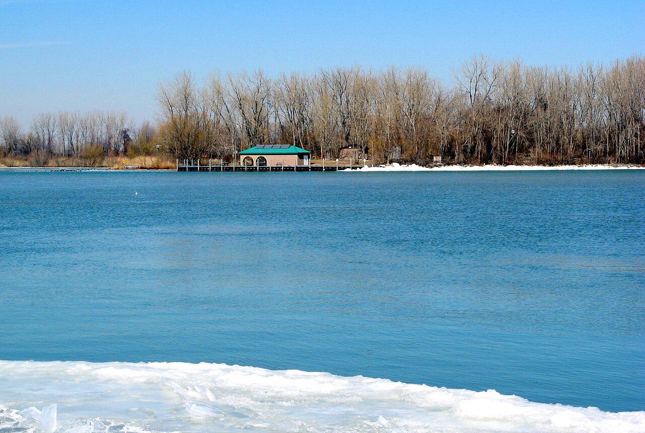
Peche Island
City of Windsor park in the Detroit River near Lake St. Clair
City of Windsor: Peche Island is a municipal park reached by boat in season. Indigenous fishing use; Laforet family farmed from the 1780s; Hiram Walker bought the island in 1883 as a summer estate. It was a provincial park from 1974 and was acquired by Windsor in 1999. Wetlands, trails and historic ruins. Neighbours still boat out for quiet days on the river. Keep Walker's industrial story on Border Cities and Works and Wages; here the island is habitat and a public shore.
Sources: City of Windsor Peche Island park page; Detroit River Canadian Cleanup Peche Island brochure; Windsor Public Library Peche Island note
Andrea_44. Peche Isle in the Detroit River, 4 Mar 2009. Wikimedia Commons. CC BY 2.0.
Marshes and hawk watch
Hillman Marsh for shorebirds; Holiday Beach for fifty seasons of volunteer raptor counts.
Free to use
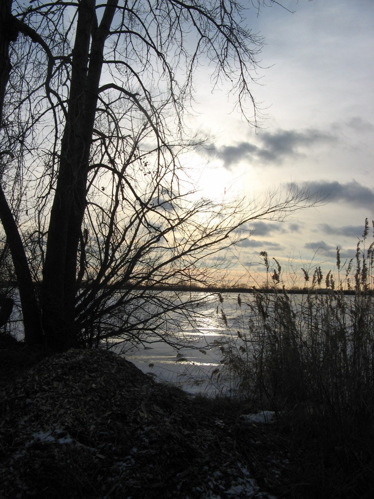
Hillman Marsh Conservation Area
ERCA marsh near Leamington; shorebird and migration stop
Essex Region Conservation Authority manages Hillman Marsh on the Lake Erie shore near Point Pelee. Trails, viewing blinds and managed mudflats draw shorebirds in spring; ERCA's Shorebird Celebration guides visitors through May identification sessions. Together with Pelee it is part of how Essex County earns its birding reputation. Neighbours who volunteer counts and keep dogs on leash are part of the resilience of this shore.
Sources: Essex Region Conservation Authority Hillman Marsh / Shorebird Festival pages; Ontario Trails Council trail note
Andrea_44. Hillman Marsh, 9 Dec 2010. Wikimedia Commons. CC BY 2.0.
Free to use
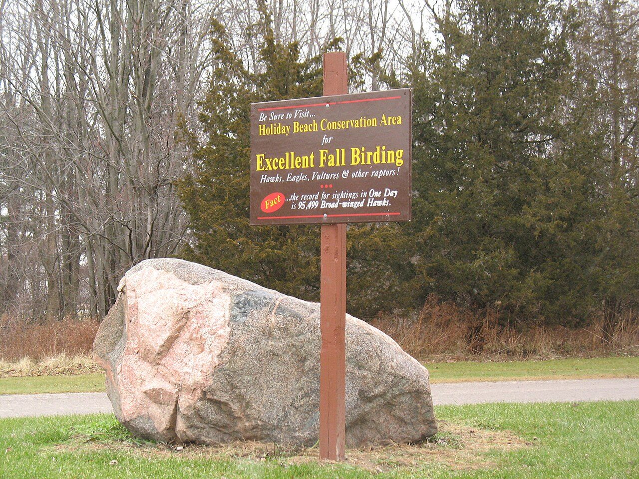
Holiday Beach hawk watch
Raptor counts since 1974; Important Bird Area
Holiday Beach Migration Observatory (HBMO), with Essex Region Conservation Authority at Holiday Beach Conservation Area near Amherstburg, has run fall raptor counts since 1974. HBMO: more than 3.8 million raptors counted over about 30,400 hours across fifty seasons. The 2013 count recorded 104,440 raptors of 19 species. Bird Studies Canada has designated the site an Important Bird Area. Volunteers on the tower and at the banding station are the human heart of this flyway story.
Sources: Holiday Beach Migration Observatory site and 50-year note; Pepper 2013 HBMO annual count report; HawkCount / IBA references in HBMO materials
Jamie. Excellent Fall Birding, Holiday Beach Conservation Area, 28 Dec 2007. Wikimedia Commons. CC BY 2.0. Place context for the hawk-watch shore, not a count-tower portrait.
City woods and Little River
Spring Garden, Devonwood and the Little River Corridor on the east end.
Free to use
Spring Garden Natural Area
Dry prairie, wetland and trail links into the Ojibway complex
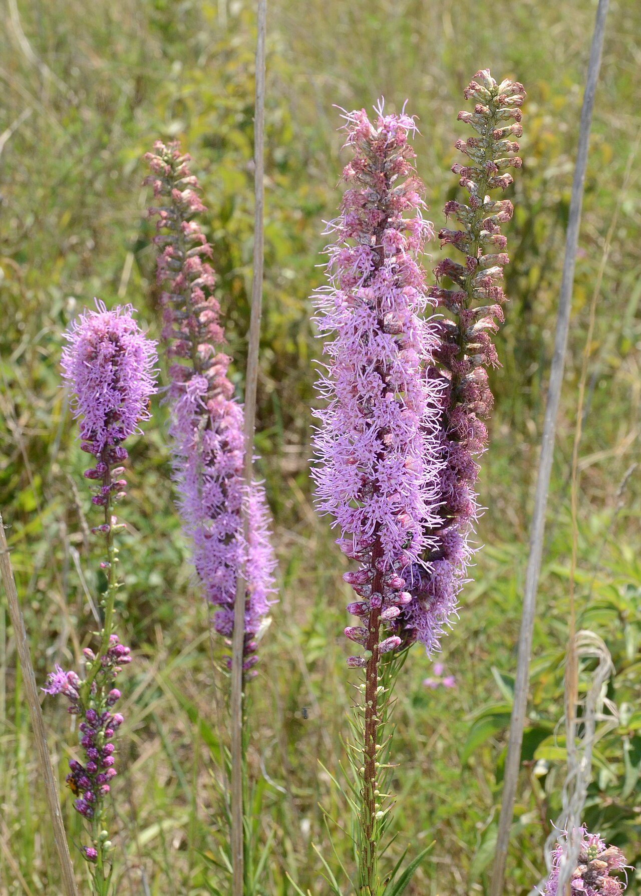
City of Windsor: Spring Garden Natural Area sits in the west end with dry prairie, buttonbush swamp and wetland, and trail ties toward Ojibway Park. Detroit River Canadian Cleanup has backed habitat restoration here. Free Commons photos show blazing star, forest habitat and the trail under local stewardship.
Sources: City of Windsor Spring Garden Natural Area page; Detroit River Canadian Cleanup Spring Garden restoration note
Mark Nenadov. Dense Blazing Star (Liatris spicata) at Spring Garden, 4 Aug 2016. Wikimedia Commons. CC BY 2.0.
Free to use
Devonwood Conservation Area
ERCA woodland in Windsor; oak diversity
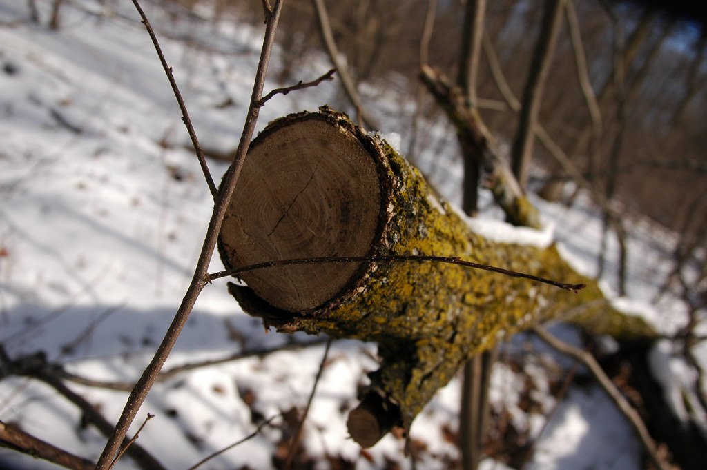
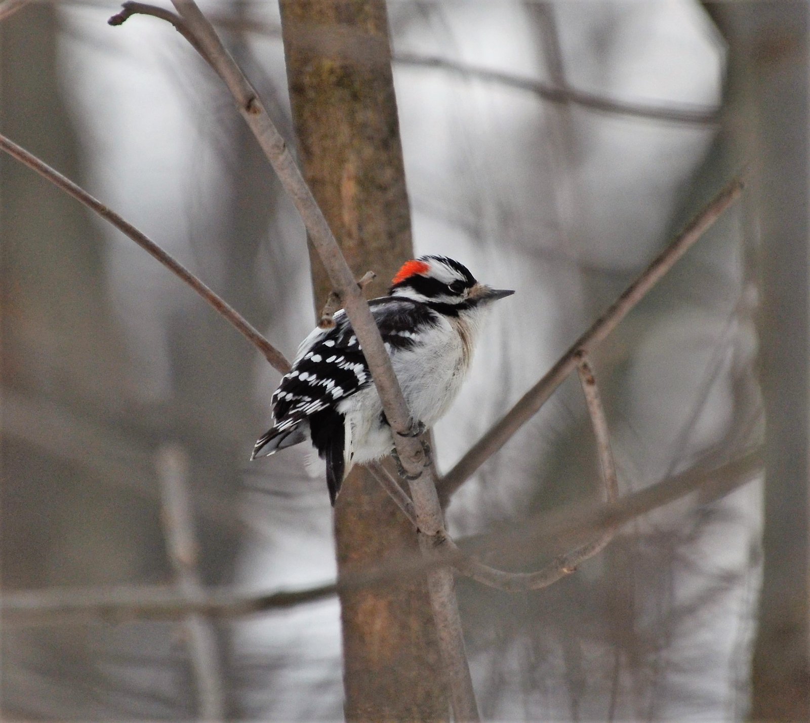
Essex Region Conservation Authority lists Devonwood as about 38 ha of woodland in Windsor with roughly 4.5 km of trails and multiple oak species, plus wildlife including owls and bats. It is the city-woods counterpart to the prairie complex: a place neighbours walk after work. The photographs here were taken at Devonwood. They are a woodland detail and a bird close-up, not an entrance or trail establishing shot.
Sources: Essex Region Conservation Authority Conservation Areas list
Woodland at Devonwood Conservation Area, February 2016. A downed tree in snow; this is a woodland detail, not an entrance or trail establishing shot. Photo: Mark Nenadov, CC BY 2.0.
A downy woodpecker at Devonwood Conservation Area, 23 December 2016. The bird was photographed at Devonwood; this is not a landscape of the area. Photo: Mark Nenadov, CC BY 2.0.
Free to use
Little River Corridor
East-end naturalized corridor; Ganatchio Trail link
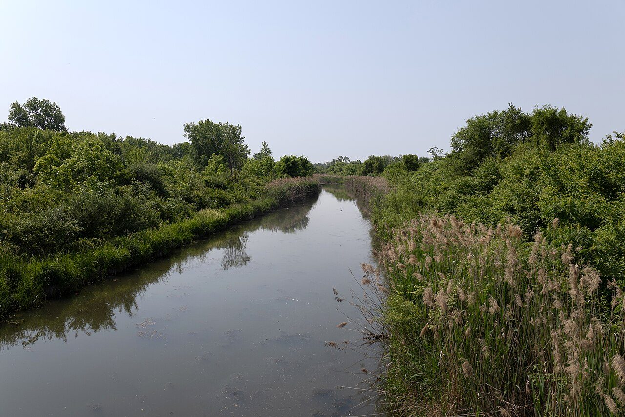
City of Windsor: Little River Corridor is a large naturalized park with wetlands, meadows, Carolinian plantings and multi-use trails. City and Society already notes the Ganatchio Trail's Little River extension (1991). This card deepens the living creek and corridor people restore and walk. Free 2025 Commons photos show the river and McHugh Bridge.
Sources: City of Windsor Little River Corridor / Little River trail pages; City and Society Ganatchio entry (cross-link)
Crisco 1492. Little River, Windsor, 11 Jun 2025. Wikimedia Commons. CC BY-SA 4.0.
Fossils and geology
Ice-age sands that feed the prairie, over Devonian bedrock. Local fossil photos still open.
Free to use
Ice-age sands and Devonian bedrock
Wisconsinan deposits over Devonian carbonates under Essex
Ontario Parks at Ojibway: layers of sand, silt, clay and till laid down about 10,000 years ago during the Wisconsinan Ice Age cover bedrock to about 30 metres; the flat sandy-to-silty plain is wet in spring and dry by late summer, which suits prairie plants. Ontario geological mapping describes Devonian carbonates (Detroit River Group and related units) under Essex County. Pelee Island exposures of Devonian rock are documented in mineralogical literature. Gap: no free Essex-labelled fossil specimen photo cleared tonight (Port Colborne Onondaga Limestone fossils are Welland County, not Essex; we will not mislabel them). Text-only until a local specimen with rights clears.
Sources: Ontario Parks Ojibway Prairie page; Ontario Geological Survey mapping notes for Essex Devonian carbonates; Mindat Pelee Island / Essex locality notes (secondary, for leads only)
Ojibway Prairie in Windsor, 6 April 2016, where ice-age sands overlie Devonian bedrock. This shows the prairie, not a cut of the sand layers or the rock. Photo: Mark Nenadov. CC BY 2.0, via Wikimedia Commons.
Chapters in view
Kyle put Natural Windsor on the list. This preview follows the approved RCR card design used on Windsor Minds and Women of Windsor.
1. Tallgrass and oak savanna
Ojibway Prairie Complex and the provincial Nature Reserve, with City and Society holding the short prairie card.
2. Carolinian shore
Point Pelee National Park, marsh and migration, as Essex County's southern Carolinian door.
3. Detroit River
Canadian Heritage River designation, flyway and Peche Island as public habitat.
4. Marshes and hawk watch
Hillman Marsh and Holiday Beach Migration Observatory volunteer counts since 1974.
5. City woods and Little River
Spring Garden, Devonwood and the Little River Corridor.
6. Fossils and geology
Ice-age sands over Devonian bedrock; local fossil specimen photo still open.
Still open
Free photos still needed: Devonwood stand labelled on Commons or ERCA open licence; Ojibway Nature Centre exterior with clear licence; named Carolinian tree portraits from Essex with find-spot; local Devonian fossil tray with museum open licence.
Fees / commercial (price to Kyle before any buy; buy nothing tonight): Windsor Star / Postmedia file of prairie fires, hawk-tower crowds, or Pelee fallouts. No price quote pulled tonight.
Permission, not a listed fee: City / ERCA / Parks Canada staff or program photos beyond what is already free on Commons.
Primary digs still open: full Ojibway ANSI boundary text; Holiday Beach all-time seasonal high from an HBMO primary table (Star "about 140,000" left as secondary); Pelee Ramsar citation PDF; Little River restoration minutes.
Do not claim: Ojibway as the place for treaty politics (that is Nations); Port Colborne fossils as Essex finds; steel-town hydrants and street-plan lore without a second independent source.
Credits and rights
Ojibway / Tallgrass / Spring Garden photos: Mark Nenadov, CC BY 2.0. Point Pelee Tip and Marsh Boardwalk; Detroit River and Little River: Chris Woodrich / Crisco 1492, CC BY-SA 4.0. Carolinian marker: Ken Lund, CC BY-SA 2.0. Peche Island and Hillman Marsh: Andrea_44, CC BY 2.0. Holiday Beach shore: Jamie, CC BY 2.0. All via Wikimedia Commons with credit on each figure. No outlet photos. We do not buy art licences tonight.
Research: desk witching-hour Ojibway notes; Ontario Parks; City of Windsor; Parks Canada; CHRS; ERCA; HBMO. Nothing on this page is live until Kyle OKs the exact text and layout. Seen a mistake, or have a free photo with clear rights? Tell us.
All chapters
Share a family photo or story
Have a photograph, a letter or a short family account from Windsor-Essex? Email a copy. Names, dates and places help. Keep your originals. We only publish with your permission, and we credit the family. Please do not send social insurance numbers, medical files or other private records.
If the button does not open mail, write us at windsornewsdesk@gmail.com with the same details. Nothing you type here is stored on this site. The fields only help fill the email on your device.

 Donate to Museum Windsor