
 Donate to Museum Windsor
Rose City Roots · Timeline · Chapter 1 of 11
Nations of the Strait
TIME IMMEMORIAL TO TODAYThe Anishinaabe of the Council of Three Fires (Ojibwe, Odawa, Potawatomi) and the Wyandot (Huron-Wendat) lived on both shores of this river long before there was a Windsor. This chapter draws first on the Nations' own published records: Walpole Island's history (Nin-Da-Waab-Jig, 2013), the Walpole Island Memorial of 1869, the Wyandot of Anderdon Nation's history and the text of the treaties themselves. Walpole Island and Caldwell First Nations have not yet reviewed it. Corrections are welcome at windsornewsdesk@gmail.com.

Timeline
- Time immemorial Homelands on both shores. The Anishinaabe Three Fires and the Wyandot live, fish, farm and trade along the strait. In the 1700s Odawa and Huron-Wendat villages stand on the south shore, the side that is now Windsor (City of Windsor archaeological plan). Sources: City of Windsor · Tourism Windsor Essex Pelee Island
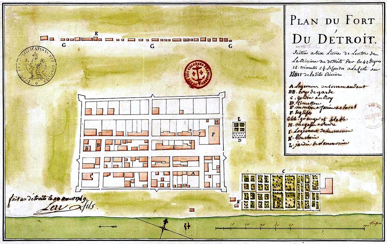
Plan du fort du Détroit, 1749. Gaspard-Joseph Chaussegros de Léry. Library and Archives Canada. Public domain. The south shore villages of the Odawa and Huron-Wendat appear on related Léry river maps of the same year. - Time immemorial to today Bkejwanong. Walpole Island First Nation, Bkejwanong, 'where the waters divide', is home to Ojibwe, Odawa and Potawatomi people of the Council of Three Fires. It is unceded territory. Sources: Ontario Heritage Trust · DOI record
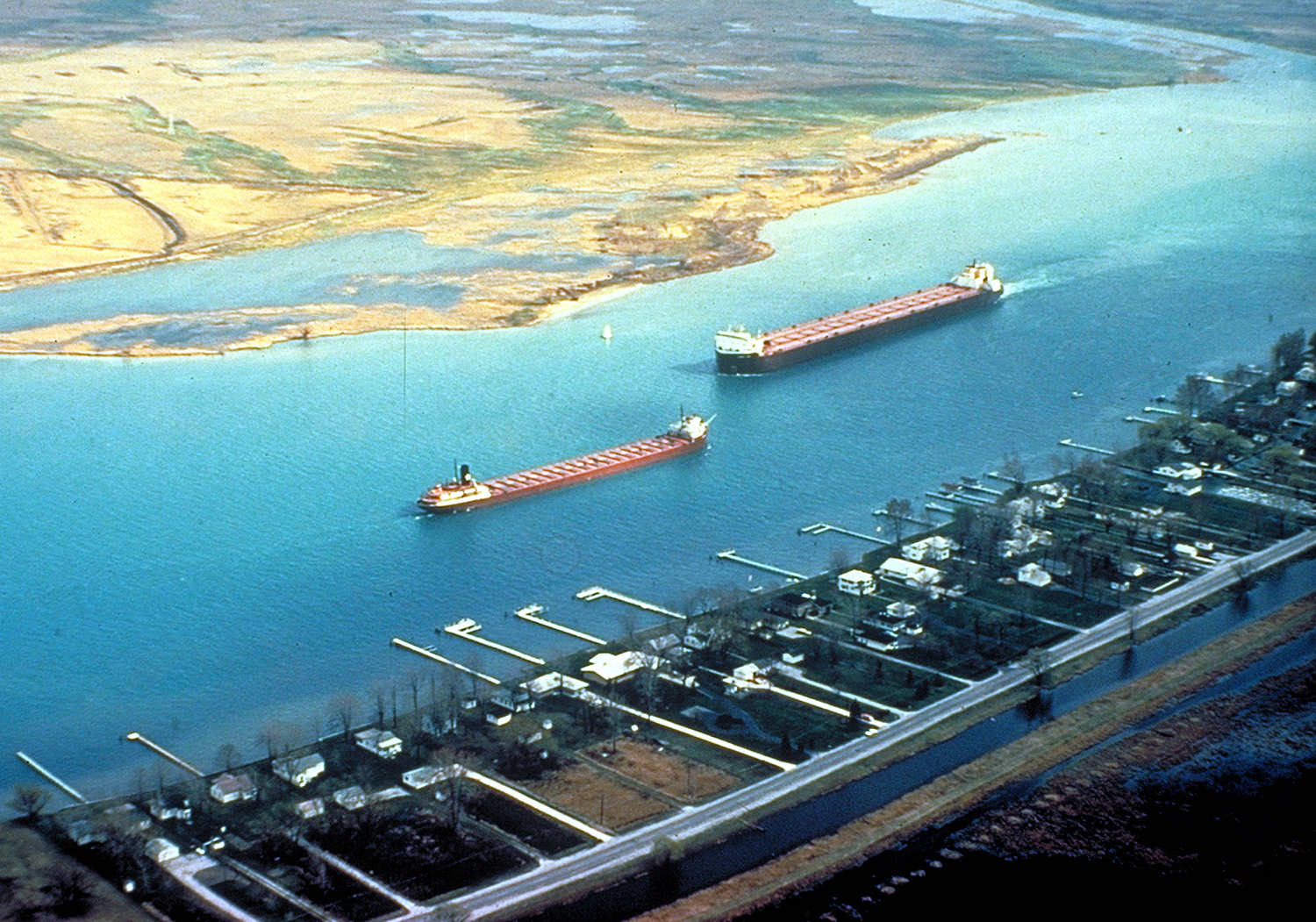
Freighters on the St. Clair River opposite Walpole Island. U.S. Army Corps of Engineers. Public domain. 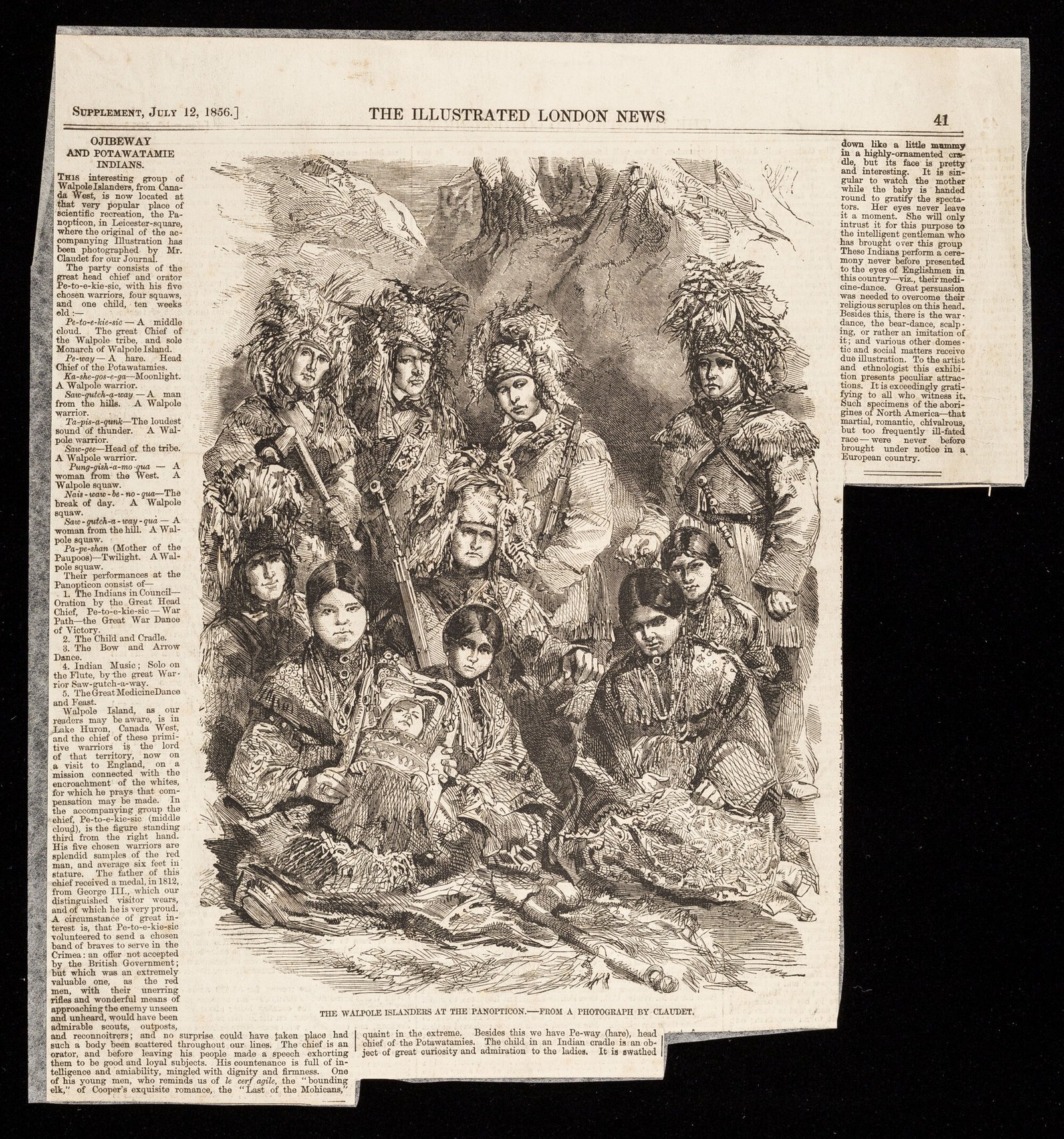
Ojibwe and Potawatomi people from Bkejwanong (Walpole Island) at the Panopticon, Leicester Square, London, 1856. Engraving after a Claudet photograph, Illustrated London News, 12 July 1856. Chief Pe-To-e-Kie-Sei (also rendered Pe-to-e-kie-sic) led the party. They were exhibited in London; this page names them as Bkejwanong visitors. Wellcome Collection. Public Domain Mark. 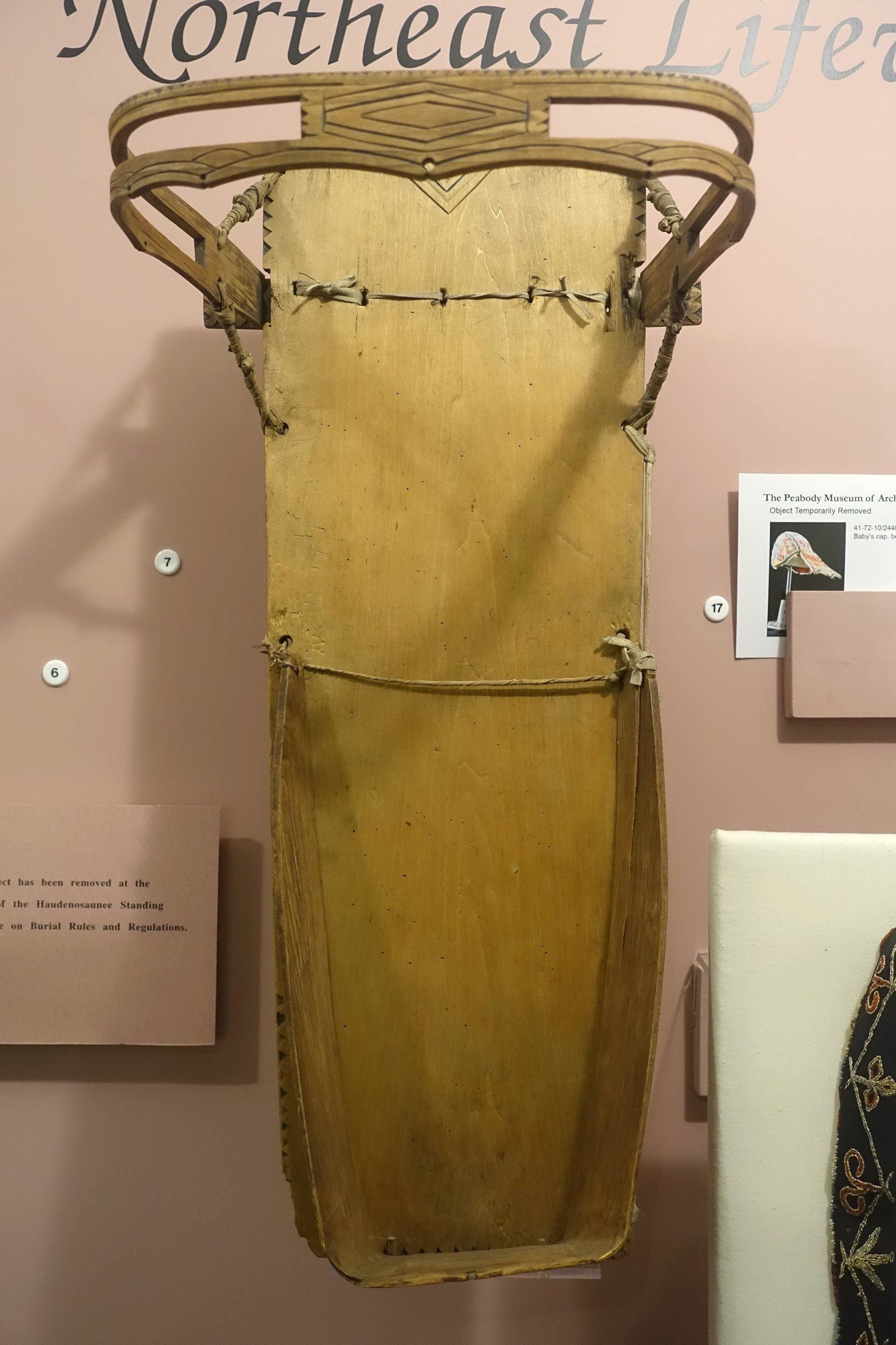
Southeastern Ojibwa cradle, made 1862, collected on Walpole Island in 1904. Peabody Museum, Harvard University (photo Daderot). Public domain. Material culture from Bkejwanong, not a ceremonial object on display as sacred. - Late 1600s A resting place at the strait. Walpole Island's own history says the Three Fires gave the Huron-Wendat a small tract at the strait to live on until they could return home. An Odawa village stood on the Canadian shore near today's tunnel. Sources: Walpole Island First Nation · Wyandot of Anderdon Nation
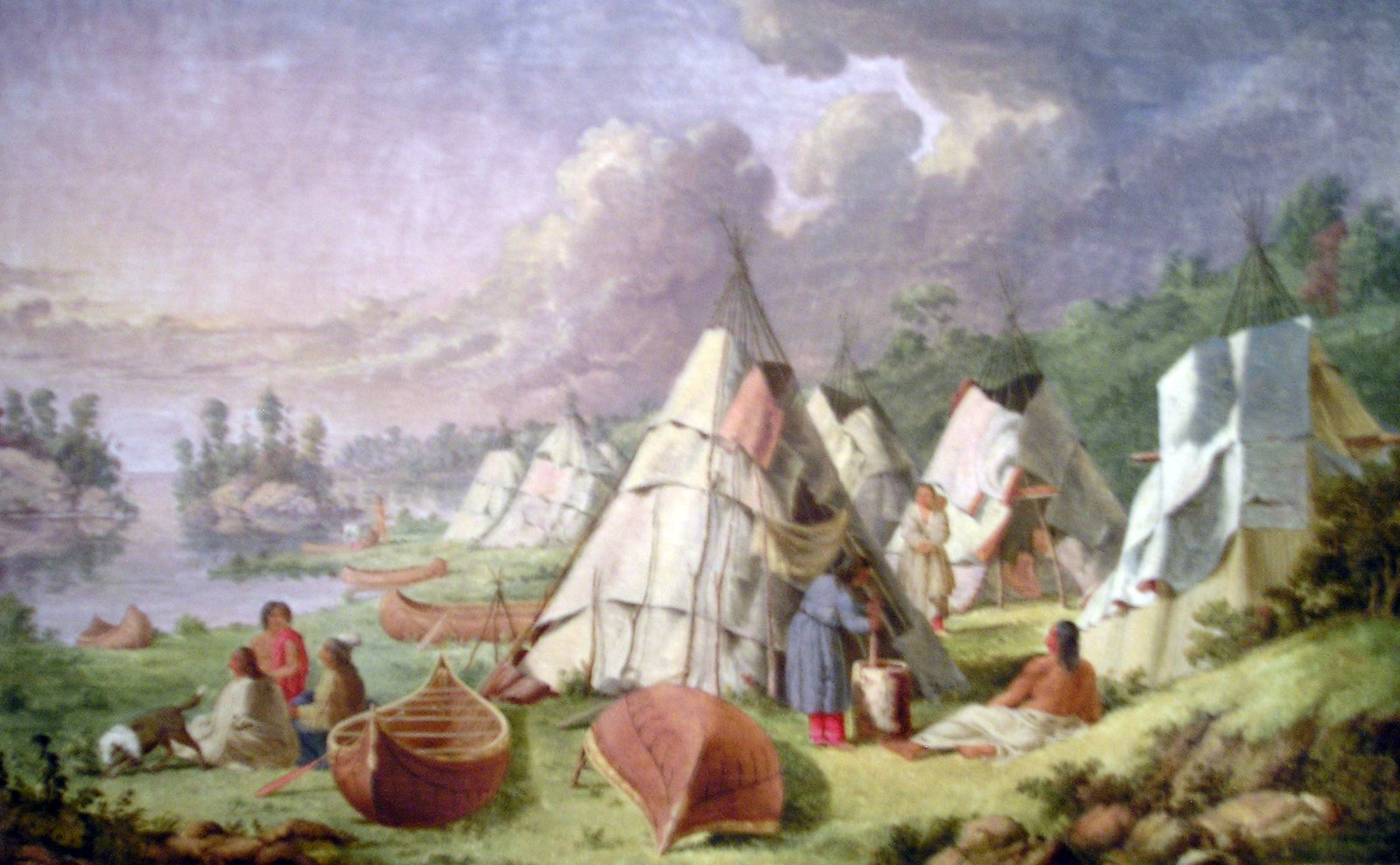
Ojibwa encampment among the islands of Lake Huron (Georgian Bay). Paul Kane. Royal Ontario Museum collection photograph of the painting. Public domain. This scene is Georgian Bay / Lake Huron, not Windsor or the Detroit River. Settler-artist view of Anishinaabe camp life. 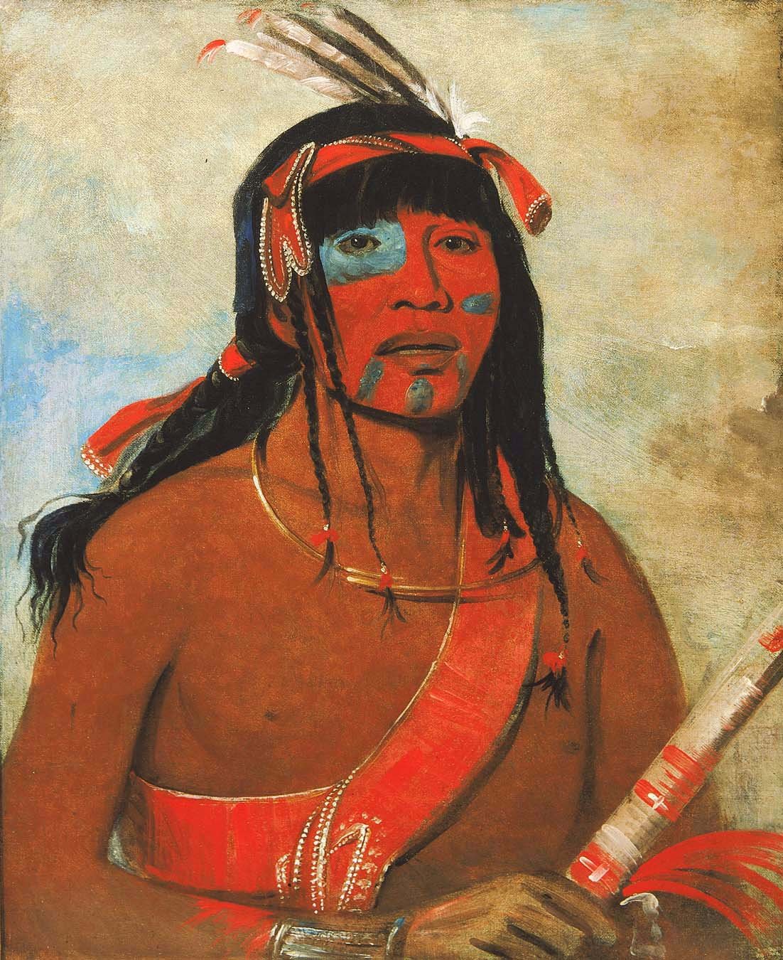
O-tá-wah (The Ottaway), an Odawa warrior, 1835. George Catlin. Smithsonian American Art Museum. Public domain. Settler-artist portrait of an Odawa man. Not painted at Windsor. 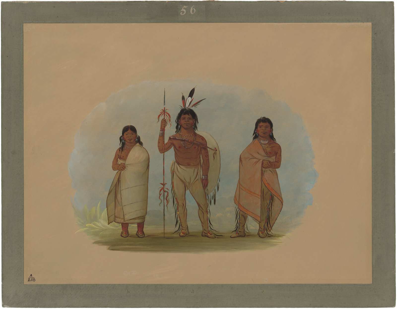
Ottawa (Odawa) chief, his wife, and a warrior, 1861/1869. George Catlin. National Gallery of Art. CC0. Settler-artist studio group. Not a Detroit River scene. 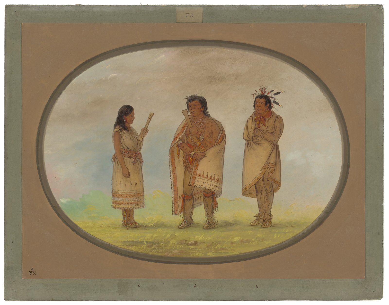
Three Potawatomi men, 1861/1869. George Catlin. National Gallery of Art. CC0. Settler-artist group. Potawatomi are one of the Three Fires of Bkejwanong; this painting is not a local portrait. - 1728 The Huron mission. A Jesuit mission to the Huron at Detroit begins the roots of today's Assumption parish. Windsor Public Library: the mission moved to Bois Blanc Island in 1742, then to la Pointe de Montréal on the south shore. Sources: Windsor Public Library · Assumption Parish
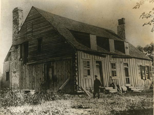
Huron Mission House, about 1895. Opposite Assumption Church. Walkerville Times Collection, Southwestern Ontario Digital Archive, Leddy Library. Public domain. - 1748 A village near today's bridge. Some Huron settle near the site of today's Ambassador Bridge and give land beside their village to the Jesuits for a church. Walpole Island's research says the Three Fires did not consent to these land gifts. Sources: Walpole Island First Nation · Windsor Public Library
- 19 May 1790 McKee's Purchase. Anishinaabe and Wyandot leaders surrender land from Lake Erie to the Thames to the Crown for £1,200 currency of the Province of Quebec in goods delivered by Alexander McKee (blankets, cloth, kettles, guns, powder, rum, a bullock and more, scheduled in the deed). Two reserves are set apart in the deed itself: one from a run near Bois Blanc Island up the strait to the French settlement above Petite Isle au D'Inde, then east seven miles and south to close (the Anderdon reserve); and another from the mouth of Rivière au Jarvais (Knagg's Creek) up the strait to the Huron Church, 120 arpents deep. Caldwell First Nation did not sign. Frans. Baby, Ensign of Militia, witnessed the deed. It was recorded at L'Assomption, District of Hesse, on 22 June 1790 (Register B, pp. 374 to 378). Sources: Indian Treaties and Surrenders (Mapping Land Theft) · Canadian Encyclopedia · Government of Canada publications
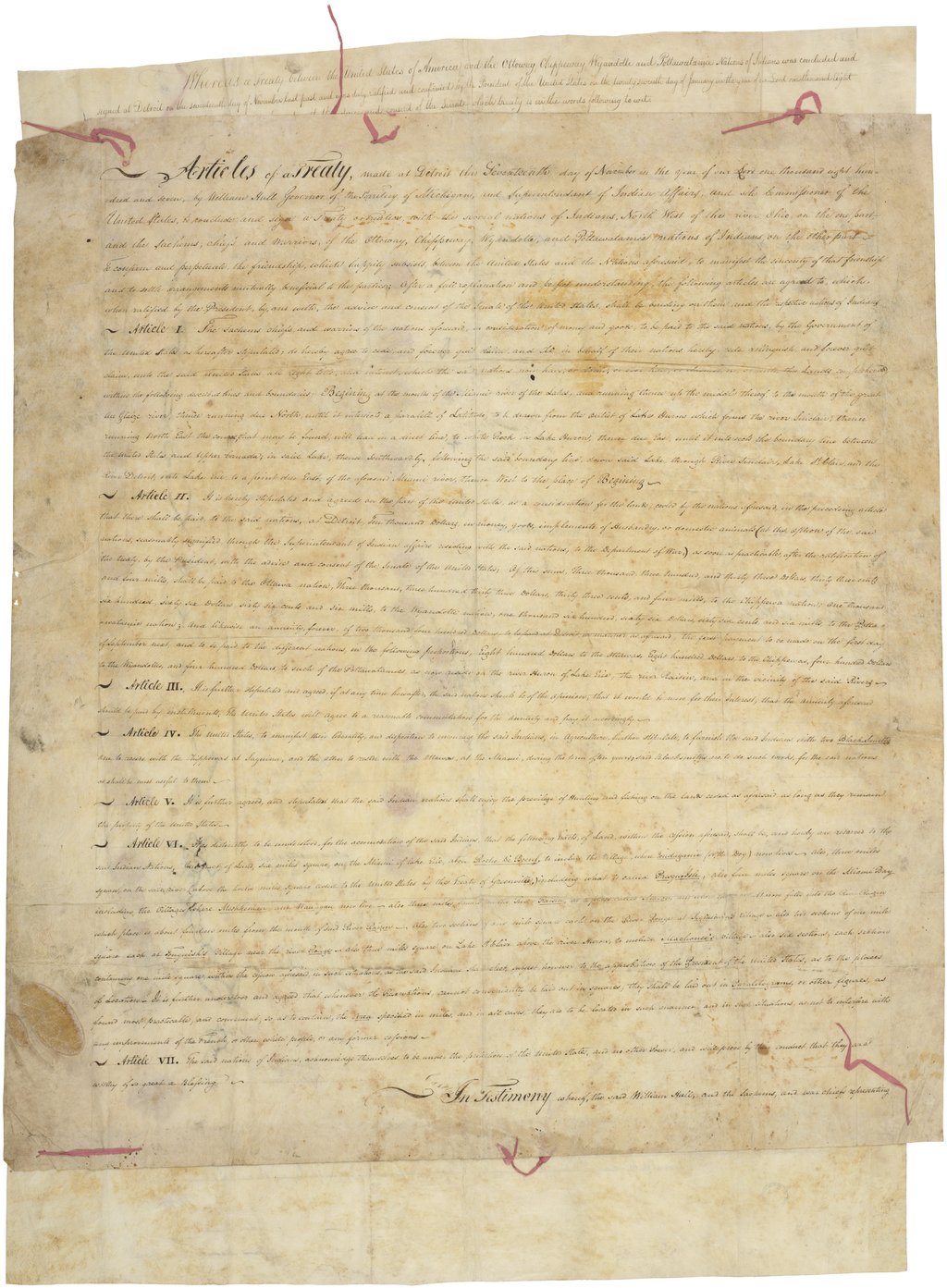
Treaty of Detroit, 17 November 1807 (manuscript). Treaty between the Ottawa, Chippewa, Wyandot and Potawatomi and the United States, signed at Detroit. Library of Congress / World Digital Library. Public domain. (U.S. side of the river; separate from McKee's Purchase of 1790.) - 1790 The Anderdon Reserve. About 200 Wyandot settle the Anderdon Reserve near Amherstburg, 23,330 acres (Wyandot of Anderdon Nation history). Sources: Wyandot of Anderdon Nation · Canadian Encyclopedia
- 1791 A rectangle becomes a triangle. Surveyor Patrick McNiff runs the Huron Church Reserve's side lines along settlers' lots. Walpole Island's analysis: the reserve shrank from about 4,560 acres, the 1790 rectangle, to about 1,139 acres. One source so far. Sources: Walpole Island First Nation
- 2 June 1797 'The proper owners of the soil'. Alexander McKee goes to Walpole Island to buy the Huron Church Reserve from the chiefs there. A provisional deal keeps 61 acres beside the church as a camping ground for Walpole Island people. One source so far. Sources: Walpole Island First Nation
- 11 September 1800 Deed No. 12. The 1,078-acre Huron Church Reserve is sold to the Crown for £300 in goods: blankets, kettles, cloth, tools, ammunition and a bullock. The same deed takes 1,334 acres by the Amherstburg garrison and a 41-acre road as a 'gift', 1,375 acres that the deed rounds to '1,380 or thereabouts'. In all, 2,412 acres and a road. Odawa, Ojibwe, Potawatomi and Wyandot chiefs signed, among them Roundhead (Ustaiechta); Thomas McKee accepted for the Crown; commissioners F. Baby and Alexander Duff witnessed. Sources: Indian Treaties and Surrenders (Mapping Land Theft) · Walpole Island First Nation
- 17 November 1807 Treaty of Detroit. The Ottawa, Chippewa, Wyandot and Potawatomi sign a treaty with the United States at Detroit, on the American side of the river, with William Hull for the United States. The manuscript survives in the Library of Congress. The printed Kappler edition matches the date and parties. Sources: Wikimedia Commons · Kappler edition (Oklahoma State University)
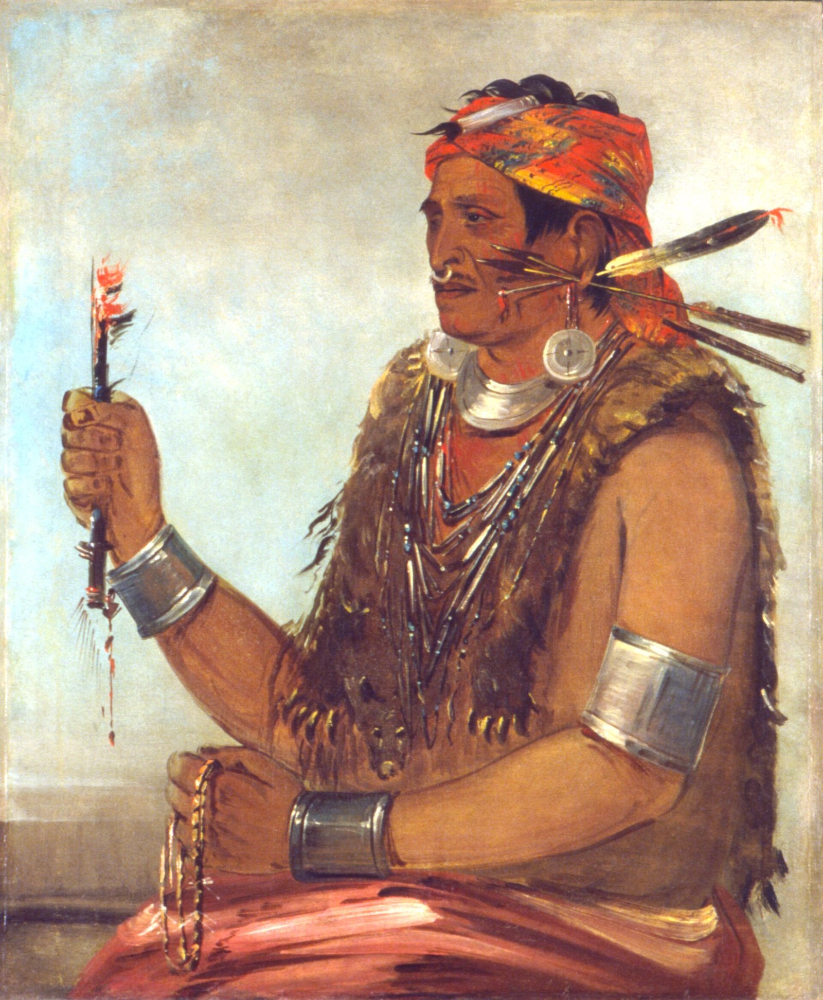
Tenskwatawa (The Prophet), Shawnee, brother of Tecumseh. George Catlin. Public domain. Shawnee homeland portrait, included for the Tecumseh / War of 1812 thread on this strait. Not a Windsor scene. - 1812 to 1813 Oshawana beside Tecumseh. Oshawana (John Naudee), later a chief at Walpole Island, was Tecumseh's chief warrior at the Battle of the Thames, 5 October 1813 (Canadian War Museum; Library and Archives Canada). Sources: Canadian War Museum · Art Canada Institute
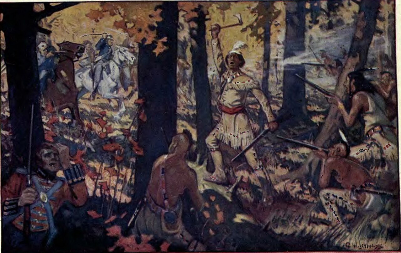
Tecumseh at the Battle of the Thames (imagined scene), 1912. C. W. Jefferys watercolour from N. S. Gurd, The Story of Tecumseh. Public domain. Oshawana (John Naudee) was Tecumseh's chief warrior at this battle. - 1836 Anderdon cut down. At Amherstburg on 20 September 1836, Wyandot chiefs and warriors propose in ITS Surrender No. 46 to give up the south third of the Huron Reserve for the general expenses of the Indians in Upper Canada, to have the Crown sell the north third for the tribe's interest, and to keep the stone quarry (and by implication the middle third). Lt. Gov. F. B. Head approved; warriors absent from council assented on 26 September 1836. The Wyandot of Anderdon Nation's history says the reserve was cut to 7,770 acres and the stone quarry; that acre figure is not in the ITS No. 46 text we have. Sources: Indian Treaties and Surrenders (Internet Archive) · Wyandot of Anderdon Nation
- 1837 and 1841 Return to Bkejwanong. Potawatomi and Odawa families return from Michigan and settle on Walpole Island. These are the dates the Nations give themselves, in their 1869 Memorial. One source so far. Sources: Internet Archive
- 1844 to 1845 The Bagot Commission survey. A report on the affairs of the Indians in Canada, commissioned by Governor General Sir Charles Bagot and laid before the Legislative Assembly on 20 March 1845, treated the Detroit River and Lake St. Clair communities as distinct administrative units. It groups Chippewas, Hurons, Shawnees and Munsees at Amherstburg and Point Pelee; Chippewas, Pottawatomies and Ottawas of Walpole Island; and a large Anderdon tract, formerly in Malden, which the commissioners put at about 23,000 acres and said had been surrendered in trust in August 1835. This is the Crown commissioners' contemporary account, not a modern land-claim finding. Sources: Report on the Affairs of the Indians in Canada, 20 March 1845 (Internet Archive)
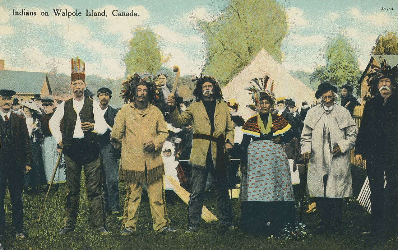
Gathering at Bkejwanong (Walpole Island), postcard mailed 7 July 1916. Printed title: "Indians on Walpole Island, Canada." Ken Levin Toledo Postcard Collection, via DPLA and Wikimedia Commons. Public domain. - 1851 to 1946 Residential schools. Walpole Island children are sent to Mount Elgin, Shingwauk, the Mohawk Institute and other schools. Mount Elgin, at Muncey, operated from 1851 to 1946. Walpole Island's memorial monument carries about 400 survivors' names. Sources: The Children Remembered · All Lit Up
- 19 July 1853 The camping ground surrendered. Indian Agent J. B. Clench certifies Surrender No. 71, by which eight named Wyandot chiefs and principal men at Anderdon (Joseph White, Matthew Greyeyes, William Clarke, Alexander Clarke, James Clarke, Joseph Warrow, Francis Parke and Alexis Matthias Splitlog) surrender a triangular tract commencing on Detroit Street, running along the Detroit River to the Huron Church line, then along a rivulet to a bridge on the Queen's Highway and back along Detroit Street (the 61-acre camping ground). Dated Anderdon, 19 July 1853. Walpole Island says the Three Fires were not party to it and calls the surrender improper. Sources: Indian Treaties and Surrenders (Internet Archive) · Walpole Island First Nation
- 1869 The Walpole Island Memorial. Printed at Sarnia and addressed to Governor General Sir John Young, it claims the Huron Reserve and Fighting, Bois Blanc, Turkey and Pelee islands. It says Bois Blanc was reserved as 'a place of landing, camping and holding Councils' and never surrendered, and that Pelee Island was only leased to Thomas McKee. One source so far. Sources: Internet Archive
- 1929 The bridge and the camping ground. Walpole Island Heritage Centre research (2013) places the Canadian end of the Ambassador Bridge inside the 61-acre camping ground, with river footings in water-bed land never surrendered. This is the Nation's research, credited to it. Sources: Walpole Island First Nation · Historic Detroit
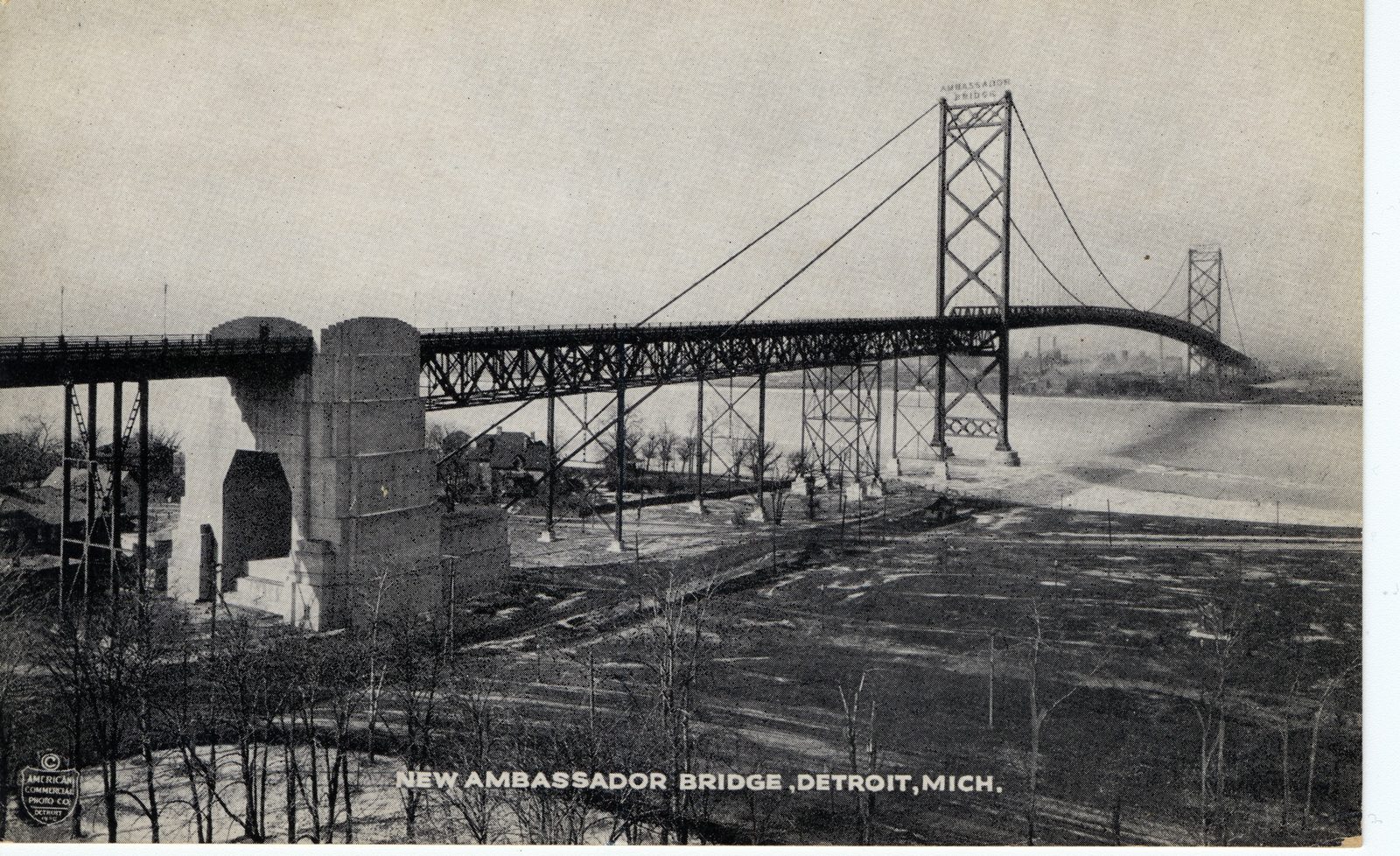
Ambassador Bridge from the Canadian side, about 1930. Postcard, American Commercial Photo Co. / Process Photo Studios. Southwestern Ontario Digital Archive / Internet Archive (2545_SWODA). Public Domain Mark 1.0. Walpole Island research places the Canadian landing inside the 1797 camping ground. - 1922 Point Pelee. Parks Canada and APTN record that Caldwell people were expelled from Point Pelee National Park, on the mainland, after it was created. Caldwell First Nation's own account, as reported by CBC, is that families were burned out of their homes 'by the RCMP' in the 1920s. Point Pelee is not Pelee Island. Sources: APTN News · CBC News
- 2010 to 2011 Caldwell's claim settled. Caldwell members approve a $105 million settlement on 21 August 2010; Canada approves it on 2 March 2011 and announces it on 25 March 2011. The claim is tied to the 1790 treaty and Point Pelee land promised in the War of 1812. Sources: Government of Canada · CBC News
- 1748 to today Names on the map. Huron Line (Huron Church Road), Wyandotte Street and Indian Road recall the Huron mission at la Pointe de Montréal (Lajeunesse's parish history, reproduced by Assumption Parish). One source so far. Sources: Assumption Parish

Nations of the Strait today
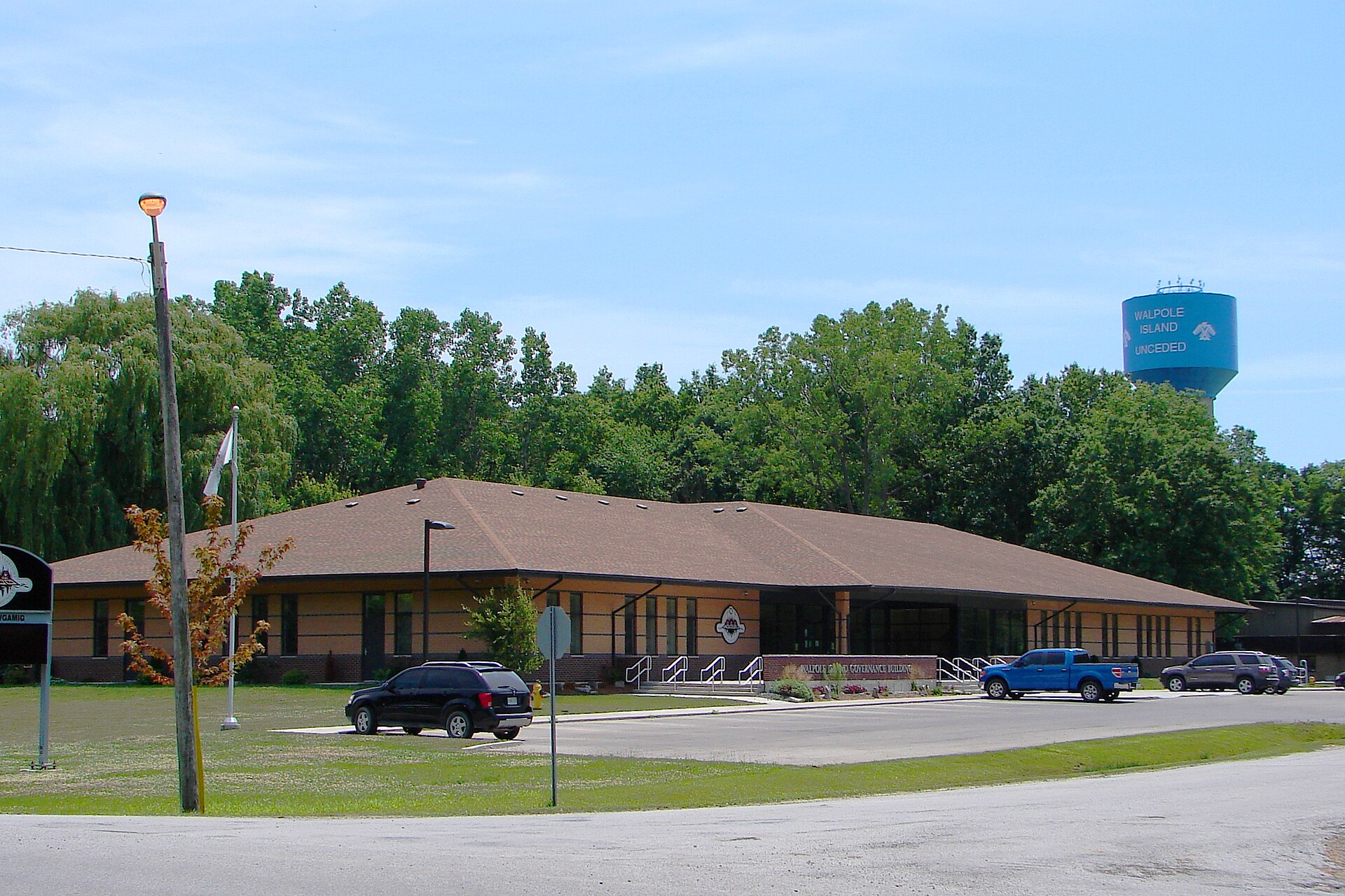
Walpole Island Community Cultural Centre, Bkejwanong, February 2024. Photo JFVoll. CC BY-SA 4.0. A living community building on the island today. - November 2020 A band without land no more. After a 230-year fight, Caldwell First Nation's land near Leamington gains reserve status (CBC, 24 November 2020). Sources: CBC News · APTN News
- 2022 Caldwell and Point Pelee. Joint conservation, ceremony and interpretation at Point Pelee National Park, described by Caldwell as true to the Anishinaabek way of life (CBC). One source so far. Sources: CBC News
- 2024 The Enniskillen claim. Canada's offer to Walpole Island, about $46 million with an option to add up to 400 acres of reserve, goes to a community vote that is put off in August 2024. Researchers said the Nation may be owed more. Sources: Chatham Daily News · Turtle Island News
- March 2025 Water. A 'do not consume' advisory at Walpole Island after an upstream spill. Bkejwanong draws its water from the St. Clair River downstream of Sarnia's chemical plants. Sources: Sydenham Current · Friends of the St. Clair River
- Every 5 May Red Dress Day. Gatherings at the Can-Am Indian Friendship Centre for missing and murdered Indigenous women, girls and two-spirit people. Sources: CBC News · Can-Am Indian Friendship Centre
- Today In the Nation's own words. Walpole Island Chief and Council publish community updates on claims and news. Sources: Walpole Island First Nation · Walpole Island First Nation
Connections between records
Links we found between separate records. Each one says how strong it is.
The deed's sketch reads 'Cession 1334 / Road 41 / 1375 Acres'. With the 1,078-acre reserve that makes 2,412 acres plus a 41-acre road, as the official index says.
How strong: Primary record. Indian Treaties and Surrenders (Mapping Land Theft) · Library and Archives Canada
Walpole Island's 1869 Memorial dates the Potawatomi and Odawa resettlement to 1837 and 1841, matching the 1830s to 1840s used in later histories.
How strong: Corroboration from the Nation's own printed record. Internet Archive
Deed No. 12 (1800) is accepted by Captain Thomas McKee, Superintendent of Indian Affairs. Walpole Island's 1869 Memorial says Pelee Island was only 'delivered by a Deed of lease to Thomas McKee' and never ceded.
How strong: Both are primary records; the pairing is ours. It is not a claim of wrongdoing. Indian Treaties and Surrenders (Mapping Land Theft) · Internet Archive
Walpole Island's 2013 research places the Ambassador Bridge's Canadian landing inside the 61-acre camping ground set aside in 1797.
How strong: The Nation's research, credited to it. Walpole Island First Nation · Historic Detroit
Six people named on the 1800 surrender had already drawn Sandwich town lots in 1797, among them the McKees, Francis and James Baby and Alexander Duff (Lajeunesse, The Windsor Border Region).
How strong: Both primary records, printed; the pairing is ours. Internet Archive · Indian Treaties and Surrenders (Mapping Land Theft)
'Frans. Baby, Ensg. Militia' witnessed the 1790 treaty that made the Huron Church Reserve; 'F. Baby, Commissioner' witnessed the 1800 deed that took it.
How strong: Both primary. F. Baby is most likely François Baby (1768 to 1852), but neither document says so. Indian Treaties and Surrenders (Mapping Land Theft) · Indian Treaties and Surrenders (Mapping Land Theft)
Alexis Matthias Splitlog signed Surrender No. 71 in 1853. An earlier dig noted Splitlog as a name to check against the Crossings chapter (the steamer Cayuga). The name on the deed is firm; any family link to the Kansas Splitlog steamer is not proven here.
How strong: Possible link only. Name match to investigate, not a claim. Indian Treaties and Surrenders (Internet Archive)
Treaty No. 2 (McKee's Purchase) was recorded at L'Assomption, District of Hesse, on 22 June 1790, six weeks after it was signed at Detroit. That is the south-shore parish seat that became Assumption.
How strong: Primary registration line. A narrative bridge between McKee's Purchase and Assumption Parish, not a legal argument. Indian Treaties and Surrenders (Mapping Land Theft)
Not yet reviewed by the Nations
Walpole Island First Nation and Caldwell First Nation have not reviewed this chapter. Where a fact comes from a Nation's own research, we say so. Corrections: windsornewsdesk@gmail.com.
Pictures


